|
search place name
|
||
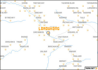
Lo Mou Kong (Vietnam)Lo Mou Kong is a town in Vietnam. An overview map of the region around Lo Mou Kong is displayed below.
regional and 3d topo map of Lo Mou Kong, Vietnam ::
Lo Mou Kong airports ::
The nearest airport is HAN - Hanoi Noibai Intl, located 178.2 km east of Lo Mou Kong.
Nearby towns ::
Co Ge Phong (2) (0.0km north) //
Mou Thi Phu (1.7km west) //
Tà Chu Van (2.5km south west) //
Nam Qua (2.5km north east) //
Poun Loung (2.5km south east) //
Gia Chu Bíng (3.4km west) //
Tao Ta Ho (4.1km north west) //
Thanh Quì (4.1km north west) //
Ku Chu Van (4.1km north west) //
Co Ge Phong (1) (3.9km north west) //
Ma Lu Ten (5.1km north west) //
Phing Chay (5.1km north west) //
Ngọc Chiến (5.1km south east) //
Nam Cat (5.1km south east) //
Kang Siou Ping (5.8km north) //
Chu Tin Van (5.5km east) //
Bản Chu Hon (5.8km south) //
Khan Pha (6.4km north east) //
Pu Niu (6.5km north west) //
Xa Loun (7.6km south) //
Nga Yang Chay (2) (7.6km north) //
Pu Niu Suối Tao (7.6km north) //
Bản The Xãng (7.1km east) //
Ping Ho (7.6km north west) //
Huối Pão (7.6km north east) //
Sao Chay (8.2km north west) //
Nga Yang Chay (1) (8.2km north west) //
Pu Chu Chay (7.8km north east) //
Co Gi San (8.2km north east) //
[all distances 'as the bird flies' and approximate] 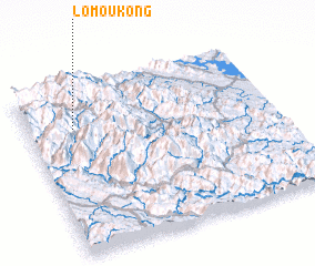 Places with similar names to Lo Mou Kong, Vietnam ::
Disclaimer :: Information on this page comes without warranty of any kind |
||
|
Where is Lo Mou Kong? Elevation and coordinates ::
Latitude (lat): 21°45'0"N Longitude (lon): 104°11'0"E
Elevation (approx.): 1230m (map arrows pan, magnifying glasses zoom) |
||
|
Visiting Lo Mou Kong? Hotel/Accommodation ::
Book a hotel in Lo Mou Kong Travel Guide ::
Buy a travel guide for Vietnam rental cars ::
car rental offers GPS waypoint ::
download a GPX waypoint (PoI) of Lo Mou Kong for your GPS receiver
|
||