|
search place name
|
||
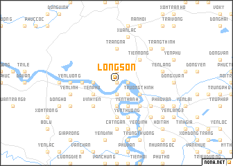
Long Sơn (Vietnam)Long Sơn is a town in Vietnam. An overview map of the region around Long Sơn is displayed below.
regional and 3d topo map of Long Sơn, Vietnam ::
Long Sơn airports ::
The nearest airport is SNO - Sakon Nakhon, located 227.6 km south west of Long Sơn.
Nearby towns ::
Phúc Hậu (NaNkm north) //
Tap Phúc (1.8km east) //
Nhân Bòi (1.8km east) //
Lương Sờn (1.9km south) //
Khã Phong (1.9km south) //
Con Trăn (1.9km north) //
Ðặng Thượng (2.6km south east) //
Trung Thịnh (3.7km south) //
Tào Thôn (3.5km west) //
Dương Long (3.5km west) //
Trương Thịnh (4.0km south east) //
Yên Thanh (4.1km south east) //
Yên Phụ (4.0km south west) //
Vinh Son (5.1km south east) //
Xuân Nhu (5.1km south east) //
Phuc Thuy (5.1km south east) //
Tiên Nông (5.1km north east) //
Vĩnh Yên (5.1km south west) //
Ða Thọ (5.3km west) //
Cẫm Vong (5.3km west) //
Trang Ná (5.6km north) //
Chi Bái (5.6km south) //
Thi Bac (5.6km south) //
An Thinh (5.8km south) //
Yên Thượng (5.8km south) //
Thanh Hoa (5.8km south) //
Ðô Lương (6.4km south east) //
Hòa Trung (6.4km south east) //
Cát Ngan (7.4km south) //
[all distances 'as the bird flies' and approximate] 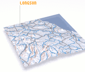 Places with similar names to Long Sơn, Vietnam ::
// Lancacen (PH)
// Linguisan (PH)
// Langgassen (DE)
// Long San (MY)
// Long Seniai (MY)
// Lang Suan (TH)
// Lungsen (IN)
// Langgasuno (ID)
// Làng Sen (LA)
// Làng San (VN)
Disclaimer :: Information on this page comes without warranty of any kind |
||
|
Where is Long Sơn? Elevation and coordinates ::
Latitude (lat): 18°56'0"N Longitude (lon): 105°16'0"E
Elevation (approx.): 20m (map arrows pan, magnifying glasses zoom) |
||
|
Visiting Long Sơn? Hotel/Accommodation ::
Book a hotel in Long Sơn Travel Guide ::
Buy a travel guide for Vietnam rental cars ::
car rental offers GPS waypoint ::
download a GPX waypoint (PoI) of Long Sơn for your GPS receiver
|
||