|
search place name
|
||
Loung Tchou (Vietnam)Loung Tchou is a town in Vietnam. An overview map of the region around Loung Tchou is displayed below.
regional and 3d topo map of Loung Tchou, Vietnam ::

Nearby towns ::
Mong Mit (1.9km south) //
Nam Pha (1.9km north) //
Ben Ho (1.7km west) //
Pa Lao (2.5km north east) //
Bản Lak (3.7km south) //
Cheu Luong (3.4km west) //
Nam Pa (3.9km south east) //
Phiêng Phát (4.1km north east) //
Ping Ho (4.1km north east) //
Ping Hang Tchai (3.9km south west) //
Nam Sat (3.9km north west) //
Nam Cum (5.1km north east) //
Nậm Pha (5.1km south west) //
Po Puong (5.2km west) //
Ho Mam Sang (5.2km east) //
Bản Pang (5.6km south) //
Bản Lak (5.6km south) //
Nậm Sát (5.6km north) //
Nam Mou Ho Pien (5.5km west) //
Nà Sẳng (5.5km east) //
Pou La (5.5km west) //
Kouei San (5.5km west) //
Mou Lao (5.5km east) //
Pắc Muôn (5.8km south) //
Tà Mít (5.8km south) //
Bản Cha Tô (6.3km south west) //
Nam Bo (6.3km north east) //
Bản Ta Lo (6.5km south west) //
Khau Giường (6.9km east) //
[all distances 'as the bird flies' and approximate] 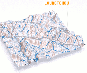 Places with similar names to Loung Tchou, Vietnam ::
Disclaimer :: Information on this page comes without warranty of any kind |
||
|
Where is Loung Tchou? Elevation and coordinates ::
Latitude (lat): 22°5'0"N Longitude (lon): 103°46'0"E
Elevation (approx.): 572m (map arrows pan, magnifying glasses zoom) |
||
|
Visiting Loung Tchou? Hotel/Accommodation ::
Book a hotel in Loung Tchou Travel Guide ::
Buy a travel guide for Vietnam rental cars ::
car rental offers GPS waypoint ::
download a GPX waypoint (PoI) of Loung Tchou for your GPS receiver
|
||