|
search place name
|
||
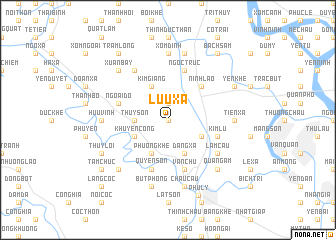
Lưu Xá (Vietnam)Lưu Xá is a town in Vietnam. An overview map of the region around Lưu Xá is displayed below.
regional and 3d topo map of Lưu Xá, Vietnam ::
Lưu Xá airports ::
The nearest airport is HAN - Hanoi Noibai Intl, located 67.4 km north of Lưu Xá.
Nearby towns ::
Phương Xá (0.0km north) //
Nhật Tựu (1.9km north) //
Thụy Sơn (3.5km west) //
Kim Giang (4.1km north west) //
Ðào Xá (4.1km north west) //
Khuyến Công (3.9km south west) //
Phương Khê (4.1km south west) //
Ðiền Xá (3.9km south east) //
Ðặng Xá (4.1km south east) //
Ninh Lão (5.1km north east) //
Ngoại Ðộ (5.5km west) //
Quyển Sơn (5.8km south) //
Kim Lũ (5.5km east) //
Kim Bảng (5.8km south) //
Vân Chu (5.8km south) //
Ngọc Trúc (5.8km north) //
Quan Tự (6.6km north west) //
Lam Cầu (6.4km south east) //
Xóm Ðình (7.4km north) //
Hưu Vĩnh (6.9km west) //
Tiên Xá (6.9km east) //
Tư Can (7.6km north) //
Bút Phong (7.6km south) //
Bản Phát Trại (7.6km south) //
Châu Cầu (7.6km south) //
Xuân Bay (7.6km north west) //
Quang Ãm (7.6km south east) //
Khả Phong (7.6km south west) //
Thụy Lôi (7.9km south west) //
[all distances 'as the bird flies' and approximate]  Places with similar names to Lưu Xá, Vietnam ::
Disclaimer :: Information on this page comes without warranty of any kind |
||
|
Where is Lưu Xá? Elevation and coordinates ::
Latitude (lat): 20°37'0"N Longitude (lon): 105°53'0"E
Elevation (approx.): 4m (map arrows pan, magnifying glasses zoom) |
||
|
Visiting Lưu Xá? Hotel/Accommodation ::
Book a hotel in Lưu Xá Travel Guide ::
Buy a travel guide for Vietnam rental cars ::
car rental offers GPS waypoint ::
download a GPX waypoint (PoI) of Lưu Xá for your GPS receiver
|
||