|
search place name
|
||
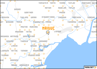
Mại Ðức (Thanh Hóa, Vietnam)Mại Ðức is a town in the Thanh Hóa region of Vietnam. An overview map of the region around Mại Ðức is displayed below.
regional and 3d topo map of Mại Ðức, Vietnam ::
Mại Ðức airports ::
The nearest airport is HAN - Hanoi Noibai Intl, located 136.2 km north of Mại Ðức.
Nearby towns ::
Nga Sơn (1.9km south) //
Xa Loan (1.9km north) //
Quang Duc (1.9km south) //
Ðông Kinh (2.5km north east) //
Lien Qui (3.5km east) //
Tri Nội (3.7km north) //
Nam Son (3.7km south) //
Bạch Câu (3.7km south) //
Hậu Trạch (4.1km south west) //
Vân Hoan (4.1km south west) //
Hợp Long (4.1km north west) //
Bao Van (3.9km south west) //
Cói Khê (3.9km south west) //
Dồng Doi (3.9km south west) //
Thượng Thọ (5.1km north west) //
Giai Uan (5.1km south west) //
Nhân Ly Ðông (5.1km south west) //
Mỹ Quan Trang (5.6km north) //
Ca Phàch (5.2km west) //
Ðạo Ðức (5.8km north) //
Gia Kiều (5.8km north) //
Yên Lương (5.8km south) //
Mỹ Ðien (5.8km south) //
Nga Châu (5.5km west) //
Kiên Giáp Ha (6.4km north east) //
Hiên Vinh (6.4km south west) //
Thạch Lễ (6.4km north west) //
Yên Ổn (6.4km south west) //
Mỹ Khuc (6.6km south west) //
[all distances 'as the bird flies' and approximate]  Places with similar names to Mại Ðức, Vietnam ::
Disclaimer :: Information on this page comes without warranty of any kind |
||
|
Where is Mại Ðức? Elevation and coordinates ::
Latitude (lat): 20°0'0"N Longitude (lon): 105°58'0"E
Elevation (approx.): 8m (map arrows pan, magnifying glasses zoom) |
||
|
Visiting Mại Ðức? Hotel/Accommodation ::
Book a hotel in Mại Ðức Travel Guide ::
Buy a travel guide for Vietnam rental cars ::
car rental offers GPS waypoint ::
download a GPX waypoint (PoI) of Mại Ðức for your GPS receiver
|
||