|
search place name
|
||
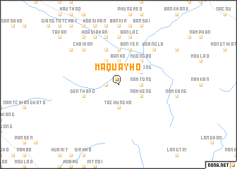
Ma Quay Hồ (Vietnam)Ma Quay Hồ is a town in Vietnam. An overview map of the region around Ma Quay Hồ is displayed below.
regional and 3d topo map of Ma Quay Hồ, Vietnam ::
Ma Quay Hồ airports ::
The nearest airport is HAN - Hanoi Noibai Intl, located 221.5 km south east of Ma Quay Hồ.
Nearby towns ::
Ta Tchuong Hồ (1.7km west) //
Nậm Tóng (3.4km east) //
Bản Dền (3.7km north) //
Bản Hồ (3.7km north) //
Tả Chung Hồ (3.7km south) //
Nàm Sang (3.9km north east) //
Nâm Tong (3.9km north east) //
Nậm Kéng (3.9km south east) //
Séo Trung Hồi (4.1km north west) //
Mường Bô (5.1km north east) //
Lếch Mán (5.6km north) //
Hoàng Liên (5.6km north) //
Vạn Dền Sứ (5.8km north) //
Dền Thàng (5.5km west) //
Bản Yên (5.8km north) //
Vang Neu Sou (7.4km north) //
Sử Pán (7.6km north) //
Bản Lac (7.6km north) //
Hoa Si Pan (7.6km north) //
Thanh Kim (7.6km north) //
Chải Mán (7.6km north west) //
Hoang La (7.6km north east) //
Hòa Sì Phán (8.2km north west) //
Giàng Tả (9.0km north west) //
Chải Mèo (9.0km north west) //
Siao Mi Ti (8.8km north west) //
[all distances 'as the bird flies' and approximate]  Places with similar names to Ma Quay Hồ, Vietnam ::
Disclaimer :: Information on this page comes without warranty of any kind |
||
|
Where is Ma Quay Hồ? Elevation and coordinates ::
Latitude (lat): 22°13'0"N Longitude (lon): 103°57'0"E
Elevation (approx.): 1065m (map arrows pan, magnifying glasses zoom) |
||
|
Visiting Ma Quay Hồ? Hotel/Accommodation ::
Book a hotel in Ma Quay Hồ Travel Guide ::
Buy a travel guide for Vietnam rental cars ::
car rental offers GPS waypoint ::
download a GPX waypoint (PoI) of Ma Quay Hồ for your GPS receiver
|
||