|
search place name
|
||
Nam Dư Thượng (Vietnam)Nam Dư Thượng is a town in Vietnam. An overview map of the region around Nam Dư Thượng is displayed below.
regional and 3d topo map of Nam Dư Thượng, Vietnam ::

Nam Dư Thượng airports ::
The nearest airport is HAN - Hanoi Noibai Intl, located 27.5 km north of Nam Dư Thượng.
Nearby towns ::
Ðông Phu (0.0km north) //
Khuyến Lương (1.9km south) //
Yên Duyên (1.9km south) //
Quỳnh Lôi (1.7km west) //
To Hoang (1.7km west) //
Vĩnh Tuy (1.9km north) //
Thúy Lĩnh (2.5km south east) //
Ðông Dư Hạ (2.5km north east) //
Dồng Trì (3.7km south) //
Lãng Yên (3.5km west) //
Thanh Nhàn (3.5km west) //
Mai Ðọng (3.5km west) //
Ðinh Công Hạ (3.5km west) //
Bát Trang (3.5km east) //
Lâm Du (3.7km north) //
Giáp Nh (3.9km south west) //
Ðông Nhân (3.9km north west) //
Kim Quan (3.9km south east) //
Xuân Quan (3.9km south east) //
Thổ Khối (3.9km north east) //
Xóm Trong (5.1km north west) //
Ngô Thôn (5.1km north east) //
Văn Ðiển (5.3km south west) //
Ðinh Công Hạ (5.2km west) //
Thuận Tốn (5.2km east) //
Bạch Mai (5.2km west) //
Cơ Xa (5.8km north) //
Phú Viên (5.8km north) //
Ngọc Lâm (5.8km north) //
[all distances 'as the bird flies' and approximate] 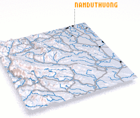 Places with similar names to Nam Dư Thượng, Vietnam :: Disclaimer :: Information on this page comes without warranty of any kind |
||
|
Where is Nam Dư Thượng? Elevation and coordinates ::
Latitude (lat): 20°59'0"N Longitude (lon): 105°53'0"E
Elevation (approx.): 9m (map arrows pan, magnifying glasses zoom) |
||
|
Visiting Nam Dư Thượng? Hotel/Accommodation ::
Book a hotel in Nam Dư Thượng Travel Guide ::
Buy a travel guide for Vietnam rental cars ::
car rental offers GPS waypoint ::
download a GPX waypoint (PoI) of Nam Dư Thượng for your GPS receiver
|
||