|
search place name
|
||
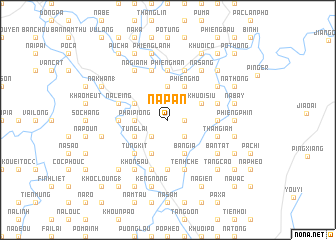
Na Pàn (Lạng Sơn, Vietnam)Na Pàn is a town in the Lạng Sơn region of Vietnam. An overview map of the region around Na Pàn is displayed below.
regional and 3d topo map of Na Pàn, Vietnam ::
Na Pàn airports ::
The nearest airport is HAN - Hanoi Noibai Intl, located 131.2 km south west of Na Pàn.
Other airports nearby include NNG - Nanning Wuxu (168.6 km east), Nearby towns ::
Ðông Sân (1.7km east) //
Khuổi Tham (2.5km south east) //
Bản Vac (2.5km south west) //
Lũng Vai (2.5km south west) //
Pa Tập (2.5km south west) //
Phai Piong (3.4km west) //
Co Cao (3.7km north) //
Cuc Mương (3.7km north) //
Bản Gia (4.1km south east) //
Lịch Sơn (4.1km south west) //
Nè Liệt (4.1km south west) //
Khuôi Siu (3.9km north east) //
Tùng Lai (3.9km south west) //
Lũng Thông (3.9km south west) //
Phiêng Mo (4.1km north east) //
Bản Pen (4.1km north east) //
Cóc Khuông (3.9km north west) //
Bản Be (3.9km north west) //
Tung Kit (5.1km south west) //
Na Kat (5.2km west) //
Co Lũng (5.2km east) //
Phiêng Mân (5.6km north) //
Bản Hu (5.6km south) //
Na Na (5.6km north) //
Bản Lịch (5.6km south) //
Hin Ðeng (5.5km east) //
Thâm Giầm (5.5km east) //
Tềnh Chè (5.8km south) //
Bản Rùa (5.8km south) //
[all distances 'as the bird flies' and approximate]  Places with similar names to Na Pàn, Vietnam ::
Disclaimer :: Information on this page comes without warranty of any kind |
||
|
Where is Na Pàn? Elevation and coordinates ::
Latitude (lat): 22°8'0"N Longitude (lon): 106°37'0"E
Elevation (approx.): 224m (map arrows pan, magnifying glasses zoom) |
||
|
Visiting Na Pàn? Hotel/Accommodation ::
Book a hotel in Na Pàn Travel Guide ::
Buy a travel guide for Vietnam rental cars ::
car rental offers GPS waypoint ::
download a GPX waypoint (PoI) of Na Pàn for your GPS receiver
|
||