|
search place name
|
||
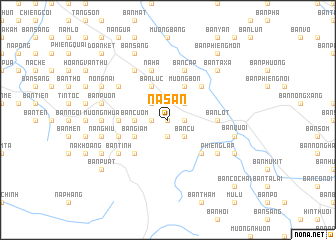
Na Sản (Sơn La, Vietnam)Na Sản is a town in the Sơn La region of Vietnam. An overview map of the region around Na Sản is displayed below.
regional and 3d topo map of Na Sản, Vietnam ::
Na Sản airports ::
The nearest airport is HAN - Hanoi Noibai Intl, located 184.2 km east of Na Sản.
Other airports nearby include LPQ - Luang Prabang Luang Phabang Intl (242.7 km south west), Nearby towns ::
Bản Cườm (0.0km north) //
Bản Cú Như (0.0km north) //
Bản Vay (1.7km west) //
Tong Ho (1.9km south) //
Bản Lat (1.7km east) //
Bản Na Sam (1.7km east) //
Bản Làu (2.5km north west) //
Bản Hời (2.5km north west) //
Bản Cụ (2.5km south east) //
Bản Nhê (2.5km south east) //
Bản Mon (2.5km north east) //
Bản Cướm (3.5km west) //
Bản Lúc (4.1km north west) //
Bản Bôm Của (4.1km north west) //
Bản Giăm (3.9km south west) //
Bản Lăm (4.1km north east) //
Bản Cút (4.1km north east) //
Mường Bón (4.1km north east) //
Bản Bông (5.1km south west) //
Bản Na Hà (5.1km south east) //
Bản Tra (5.1km north east) //
Bản Cứp (5.2km west) //
Bản Lót (5.2km east) //
Na Ha (5.8km north) //
Bản Tình (5.5km west) //
Nà Lon (5.5km west) //
Bản Bó (5.8km north) //
Bản Cáp (5.8km north) //
Bản Tình (6.4km south west) //
[all distances 'as the bird flies' and approximate]  Places with similar names to Na Sản, Vietnam ::
Disclaimer :: Information on this page comes without warranty of any kind |
||
|
Where is Na Sản? Elevation and coordinates ::
Latitude (lat): 21°12'0"N Longitude (lon): 104°2'0"E
Elevation (approx.): 634m (map arrows pan, magnifying glasses zoom) |
||
|
Visiting Na Sản? Hotel/Accommodation ::
Book a hotel in Na Sản Travel Guide ::
Buy a travel guide for Vietnam rental cars ::
car rental offers GPS waypoint ::
download a GPX waypoint (PoI) of Na Sản for your GPS receiver
|
||