|
search place name
|
||
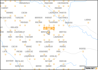
Na Tho (Cao Bằng, Vietnam)Na Tho is a town in the Cao Bằng region of Vietnam. An overview map of the region around Na Tho is displayed below.
regional and 3d topo map of Na Tho, Vietnam ::
Na Tho airports ::
The nearest airport is HAN - Hanoi Noibai Intl, located 153.0 km south west of Na Tho.
Other airports nearby include NNG - Nanning Wuxu (171.4 km east), Nearby towns ::
Loung Tam (1.7km east) //
Na Man (1.7km east) //
Na Lan (1.7km east) //
Ðào Ninh (1.9km south) //
Bản La Neu (1.9km north) //
Bản Vi (1.7km west) //
Dong Ma (1.7km west) //
Bản Phuong (2.5km north east) //
Pac Gien (2.5km south west) //
Bản Han (2.5km south west) //
Bản Po (3.4km east) //
Loung Cai (3.7km south) //
Kouei Cap (3.7km north) //
Loung Nam (3.9km south east) //
Thin Phân (4.1km north east) //
Na Kat (4.1km north west) //
Bản Niên (3.9km north west) //
Na Lip (5.0km north east) //
Na Tạo (5.0km south west) //
Pac Nam (5.0km north west) //
Bán Teu (5.1km east) //
Loung Xa (5.6km south) //
Pia Niot (5.6km north) //
Can Xang (5.6km south) //
Loung Banh (5.5km east) //
Bản Luong (5.8km north) //
Na Sing (6.5km north east) //
Khao Danh (6.5km south east) //
Cần Phán (6.5km north east) //
[all distances 'as the bird flies' and approximate] 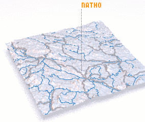 Places with similar names to Na Tho, Vietnam ::
Disclaimer :: Information on this page comes without warranty of any kind |
||
|
Where is Na Tho? Elevation and coordinates ::
Latitude (lat): 22°26'0"N Longitude (lon): 106°31'0"E
Elevation (approx.): 285m (map arrows pan, magnifying glasses zoom) |
||
|
Visiting Na Tho? Hotel/Accommodation ::
Book a hotel in Na Tho Travel Guide ::
Buy a travel guide for Vietnam rental cars ::
car rental offers GPS waypoint ::
download a GPX waypoint (PoI) of Na Tho for your GPS receiver
|
||