|
search place name
|
||
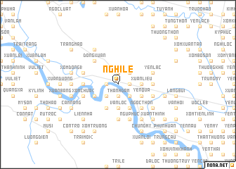
Nghi Lệ (Vietnam)Nghi Lệ is a town in Vietnam. An overview map of the region around Nghi Lệ is displayed below.
regional and 3d topo map of Nghi Lệ, Vietnam ::
Nghi Lệ airports ::
The nearest airport is SNO - Sakon Nakhon, located 221.7 km south west of Nghi Lệ.
Nearby towns ::
Cho Don (1.9km south) //
Thanh Ðàm (1.9km south) //
Thanh Thủy (1.9km north) //
Nam Ðàn (1.8km west) //
Xuân Hồ (1.8km east) //
Ðan Nhiễm (1.8km east) //
Nam Ðông (1.8km east) //
Qui Chính (1.9km north) //
Văn Lâm (2.6km south east) //
Khọa Trương (2.6km south west) //
Xóm Trung Hoa (2.6km north east) //
Thanh Dàm (3.5km east) //
Xuân Lieu (3.5km east) //
Van Loc (3.7km south) //
Bố Ðức (4.0km south east) //
Duyên Lãm (4.0km south west) //
Yen Quả (4.0km south east) //
Kha Lãm (4.1km south west) //
Dóng Nhân (4.1km south east) //
Ngọc Thôn (5.1km south east) //
Cửu Yên (5.1km south east) //
Ðông Xuân (5.1km north west) //
Làng Ða Lac (5.3km east) //
Xóm Ðình (1) (5.3km west) //
Ðặng Xa (5.6km south) //
Kim Liêu (5.6km east) //
Gia Lạc (5.6km east) //
Xóm Chùa (2) (5.6km west) //
Yên Lạc (5.6km east) //
[all distances 'as the bird flies' and approximate] 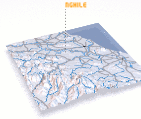 Places with similar names to Nghi Lệ, Vietnam ::
Disclaimer :: Information on this page comes without warranty of any kind |
||
|
Where is Nghi Lệ? Elevation and coordinates ::
Latitude (lat): 18°42'0"N Longitude (lon): 105°30'0"E
Elevation (approx.): 6m (map arrows pan, magnifying glasses zoom) |
||
|
Visiting Nghi Lệ? Hotel/Accommodation ::
Book a hotel in Nghi Lệ Travel Guide ::
Buy a travel guide for Vietnam rental cars ::
car rental offers GPS waypoint ::
download a GPX waypoint (PoI) of Nghi Lệ for your GPS receiver
|
||