|
search place name
|
||
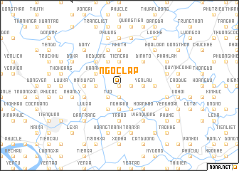
Ngọc Lập (Hải Hưng, Vietnam)Ngọc Lập is a town in the Hải Hưng region of Vietnam. An overview map of the region around Ngọc Lập is displayed below.
regional and 3d topo map of Ngọc Lập, Vietnam ::
Ngọc Lập airports ::
The nearest airport is HAN - Hanoi Noibai Intl, located 59.8 km north west of Ngọc Lập.
Nearby towns ::
Yên Xá (0.0km north) //
Ðông La (1.7km east) //
Vũ Xá (1.9km north) //
Từ Xá (1.9km south) //
Từ Ô (2.5km south west) //
Cao Xá (3.7km north) //
Tiên Cầu (3.7km north) //
Nghĩa Vũ (3.7km south) //
Yến Lâu (3.5km east) //
Hoàng Xuyên (3.5km west) //
Duyệt Lễ (4.1km south east) //
Kinh Dương (4.1km north west) //
Bình Lăng (4.1km south west) //
Văn Nhuệ (3.9km north west) //
Ðình Tổ (5.1km north east) //
Bằng Cách (5.1km north east) //
Hoành Bồ (5.1km south east) //
Vệ Dương (5.1km north west) //
Mai Xuyên (5.2km west) //
Nhữ Th (5.6km north) //
Trà Bồ (5.6km south) //
Ngọc Cục (5.6km north) //
Thọ Trương (5.2km east) //
Ðào Xá (5.8km north) //
Hà Xá (5.8km north) //
Mão Cầu (5.5km west) //
Lưu Xá (6.4km south west) //
Viên Quang (6.6km south east) //
Mộ Trạch (7.4km north) //
[all distances 'as the bird flies' and approximate]  Places with similar names to Ngọc Lập, Vietnam ::
Disclaimer :: Information on this page comes without warranty of any kind |
||
|
Where is Ngọc Lập? Elevation and coordinates ::
Latitude (lat): 20°48'0"N Longitude (lon): 106°10'0"E
Elevation (approx.): 4m (map arrows pan, magnifying glasses zoom) |
||
|
Visiting Ngọc Lập? Hotel/Accommodation ::
Book a hotel in Ngọc Lập Travel Guide ::
Buy a travel guide for Vietnam rental cars ::
car rental offers GPS waypoint ::
download a GPX waypoint (PoI) of Ngọc Lập for your GPS receiver
|
||