|
search place name
|
||
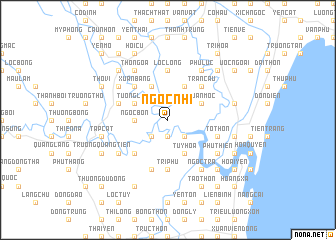
Ngọc Nhĩ (Thanh Hóa, Vietnam)Ngọc Nhĩ is a town in the Thanh Hóa region of Vietnam. An overview map of the region around Ngọc Nhĩ is displayed below.
regional and 3d topo map of Ngọc Nhĩ, Vietnam ::
Ngọc Nhĩ airports ::
The nearest airport is HAN - Hanoi Noibai Intl, located 174.1 km north of Ngọc Nhĩ.
Nearby towns ::
Trung Liệt (1.9km south) //
Sài Thôn (2.5km south west) //
Yên Lăng (2.5km south east) //
Ngọc Bồn (3.5km west) //
Lam Cầu (4.1km north west) //
Tường Loan (4.0km north west) //
Hanh Thòn (4.0km north west) //
Quan Hoạch (4.0km north west) //
Tê Ðộ (4.0km north west) //
Tuy Hóa (4.1km south east) //
Kim Quất (4.1km north east) //
Xuân Mộc (4.0km north east) //
Phú Viên (5.1km south west) //
Xuân Bảng (5.1km north west) //
Quả Cẩm (5.1km north west) //
Thịnh Lạc (5.1km north west) //
Ngưu Trung (5.1km north east) //
Trân Cầu (5.1km north east) //
Gia Hà (5.1km north east) //
Trí Phú (5.6km south) //
Lộc Long (5.6km north) //
Phú Ða Hậu (5.8km south) //
Ngọc Phương (5.6km east) //
Tố Thôn (5.6km east) //
Côn Cương (5.6km west) //
Phu Nẫm (6.4km south west) //
Phú Thiện (6.4km south east) //
Thổ Ngõa (6.6km north west) //
Thanh Tháp (6.4km north west) //
[all distances 'as the bird flies' and approximate] 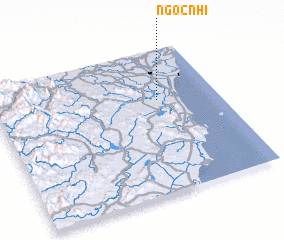 Places with similar names to Ngọc Nhĩ, Vietnam ::
// Ngọc Nha (4) (VN)
Disclaimer :: Information on this page comes without warranty of any kind |
||
|
Where is Ngọc Nhĩ? Elevation and coordinates ::
Latitude (lat): 19°39'0"N Longitude (lon): 105°44'0"E
Elevation (approx.): 4m (map arrows pan, magnifying glasses zoom) |
||
|
Visiting Ngọc Nhĩ? Hotel/Accommodation ::
Book a hotel in Ngọc Nhĩ Travel Guide ::
Buy a travel guide for Vietnam rental cars ::
car rental offers GPS waypoint ::
download a GPX waypoint (PoI) of Ngọc Nhĩ for your GPS receiver
|
||