|
search place name
|
||
Pac Lũng (1) (Lạng Sơn, Vietnam)Pac Lũng (1) is a town in the Lạng Sơn region of Vietnam. An overview map of the region around Pac Lũng (1) is displayed below.
regional and 3d topo map of Pac Lũng (1), Vietnam ::

Pac Lũng (1) airports ::
The nearest airport is HAN - Hanoi Noibai Intl, located 106.4 km south west of Pac Lũng (1).
Other airports nearby include NNG - Nanning Wuxu (184.1 km north east), Nearby towns ::
Bô Chua (1.7km west) //
Bình Ðãng (1.9km north) //
Bản Pan (2.5km south west) //
Lung Lách (3.4km west) //
Ðiềm He (4.1km north east) //
Văn Quan (4.1km north east) //
Khôn Pen (4.1km south east) //
Ðức Hinh (3.9km north west) //
Bản Nang (3.9km south east) //
Bản King (5.1km north west) //
Bản Lan (5.1km north east) //
Na Anh (5.2km west) //
Nà Rẻ (5.5km east) //
Thôn Khe (5.5km west) //
Quy Hậu (6.5km south east) //
Ba Xã (6.5km south east) //
Mô Pia (6.9km west) //
Bác Lang (7.4km north) //
Nà Ro (7.6km north) //
Na Hao (7.8km north west) //
Khuông Cồc (7.8km north east) //
Khánh Khê (7.8km north east) //
Phái Lang (8.2km south east) //
Na Vang (8.8km north west) //
Cho Bai (9.0km south west) //
[all distances 'as the bird flies' and approximate] 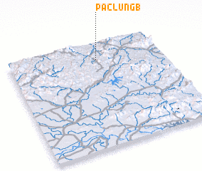 Places with similar names to Pac Lũng (1), Vietnam ::
// Pac Loung (1) (VN)
Disclaimer :: Information on this page comes without warranty of any kind |
||
|
Where is Pac Lũng (1)? Elevation and coordinates ::
Latitude (lat): 21°51'0"N Longitude (lon): 106°35'0"E
Elevation (approx.): 317m (map arrows pan, magnifying glasses zoom) |
||
|
Visiting Pac Lũng (1)? Hotel/Accommodation ::
Book a hotel in Pac Lũng (1) Travel Guide ::
Buy a travel guide for Vietnam rental cars ::
car rental offers GPS waypoint ::
download a GPX waypoint (PoI) of Pac Lũng (1) for your GPS receiver
|
||