|
search place name
|
||
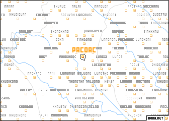
Pác Oạc (Cao Bằng, Vietnam)Pác Oạc is a town in the Cao Bằng region of Vietnam. An overview map of the region around Pác Oạc is displayed below.
regional and 3d topo map of Pác Oạc, Vietnam ::
Pác Oạc airports ::
The nearest airport is HAN - Hanoi Noibai Intl, located 170.3 km south of Pác Oạc.
Other airports nearby include NNG - Nanning Wuxu (180.6 km east), Nearby towns ::
Lũng Các (1.7km east) //
Nà Giu (1.9km south) //
Lũng Miầu (1.9km south) //
Lũng Sì (1.9km north) //
Thong Chao (2.5km north east) //
Tẩu Thong (2.5km south west) //
Ðồng Ða (2.5km south west) //
Lũng Mớ (2.5km north west) //
Bó Luông (3.7km south) //
Pác Sằng (3.7km north) //
Tình Ðông (3.7km north) //
Lũng Xi (3.4km east) //
Phia Khao (2) (3.4km west) //
Co Quân (3.4km west) //
Bó Huy (4.1km south east) //
Lạc Giển Tẩu (3.9km south east) //
Bản Chang (1) (3.9km north west) //
Lũng Thỏ (5.0km south east) //
Lũng Niên (5.0km south west) //
Lũng Man (5.6km north) //
Nà Luông (5.8km south) //
Quảng Uyên (5.8km north) //
Bà Dương (5.8km north) //
Lũng Nhân (5.8km south) //
Thổng Thá (5.8km south) //
Lũng Rìa Tẩu (5.8km north) //
Bó Oat (5.5km east) //
Bó Cái (5.5km east) //
Canh Man (5.5km east) //
[all distances 'as the bird flies' and approximate] 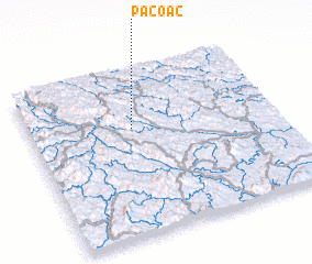 Places with similar names to Pác Oạc, Vietnam ::
Disclaimer :: Information on this page comes without warranty of any kind |
||
|
Where is Pác Oạc? Elevation and coordinates ::
Latitude (lat): 22°39'0"N Longitude (lon): 106°25'0"E
Elevation (approx.): 470m (map arrows pan, magnifying glasses zoom) |
||
|
Visiting Pác Oạc? Hotel/Accommodation ::
Book a hotel in Pác Oạc Travel Guide ::
Buy a travel guide for Vietnam rental cars ::
car rental offers GPS waypoint ::
download a GPX waypoint (PoI) of Pác Oạc for your GPS receiver
|
||