|
search place name
|
||
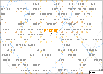
Pac Pen (Lạng Sơn, Vietnam)Pac Pen is a town in the Lạng Sơn region of Vietnam. An overview map of the region around Pac Pen is displayed below.
regional and 3d topo map of Pac Pen, Vietnam ::
Pac Pen airports ::
The nearest airport is HAN - Hanoi Noibai Intl, located 116.7 km south west of Pac Pen.
Other airports nearby include NNG - Nanning Wuxu (178.6 km north east), Nearby towns ::
Nà Nhung (1.7km east) //
Mỹ Lét (1.9km south) //
Mỹ Liệt (1.9km south) //
Bản Nam (2.5km north east) //
Puòng Lâu (2.5km north east) //
Phiên Lai (2.5km south west) //
Tá Piác (3.4km east) //
Khon Thom (3.7km north) //
Bản Dôn (3.7km north) //
Khoun Pao (3.7km north) //
Khon Boun (3.7km north) //
Nha Trai (3.4km west) //
Bình Khát (3.9km south east) //
Bản Xa (3.9km north east) //
Pô Mainh (3.9km north west) //
Bản Sát (3.9km north west) //
Cóc Công (3.9km south west) //
Khaou Khoc (5.1km north west) //
Côc Hát (5.2km east) //
Khôn Bung (5.8km north) //
Nãm Tâu (5.8km north) //
Na Tinh (1) (5.5km east) //
Diền Phong (5.5km east) //
Pò Pheo (5.5km east) //
Bản Han (5.8km north) //
Khon Man (6.3km north west) //
Na Louc (6.3km north west) //
Nà Rươc (6.3km south east) //
Nà Chen (6.5km south east) //
[all distances 'as the bird flies' and approximate]  Places with similar names to Pac Pen, Vietnam ::
Disclaimer :: Information on this page comes without warranty of any kind |
||
|
Where is Pac Pen? Elevation and coordinates ::
Latitude (lat): 22°0'0"N Longitude (lon): 106°34'0"E
Elevation (approx.): 222m (map arrows pan, magnifying glasses zoom) |
||
|
Visiting Pac Pen? Hotel/Accommodation ::
Book a hotel in Pac Pen Travel Guide ::
Buy a travel guide for Vietnam rental cars ::
car rental offers GPS waypoint ::
download a GPX waypoint (PoI) of Pac Pen for your GPS receiver
|
||