|
search place name
|
||
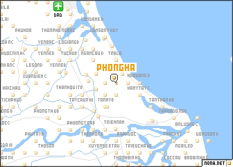
Phong Hà (Quảng Nam-Ðà Nẵng, Vietnam)Phong Hà is a town in the Quảng Nam-Ðà Nẵng region of Vietnam. An overview map of the region around Phong Hà is displayed below.
regional and 3d topo map of Phong Hà, Vietnam ::
Phong Hà airports ::
The nearest airport is DAD - Danang Intl, located 15.2 km north west of Phong Hà.
Nearby towns ::
Ðông Thôi (0.0km north) //
Hà Quảng (4) (1.7km north east) //
Ngân Câu (1) (1.8km west) //
Quảng Hà (1) (1.8km west) //
Lai Nghê (2) (1.9km south) //
Hà Bàng (1.8km east) //
Cổ Lưu (1) (2.5km south west) //
Phong Hồ (1) (3.3km west) //
Ngân Câu (2) (3.5km north west) //
Câu Hà (2) (3.7km north) //
Trà Lộ (3.7km north) //
Trà Khê (1) (3.7km north) //
Hà Quảng (1) (3.6km east) //
Hà Quảng (3) (3.6km east) //
Tân Mỹ (1) (4.0km south) //
Cổ Lưu (2) (4.1km south west) //
Hà My Tây (2) (4.0km south east) //
Thanh Quít (2) (4.4km west) //
Ngân Trung (2) (4.9km west) //
Ngân Câu (3) (5.1km north west) //
Ðông Lũy Tây (1) (5.6km south west) //
Phong Ngũ (1) (5.7km west) //
Ðiện Bàn (6.0km south west) //
Tân An (6.1km north) //
Tây Câu Nhi (6.5km south west) //
Bình Kỳ (1) (6.6km north west) //
An Bàn (2) (6.5km south east) //
Triềm Nam (7.4km south) //
Tân Lưu (7.5km north) //
[all distances 'as the bird flies' and approximate] 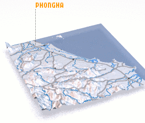 Places with similar names to Phong Hà, Vietnam ::
Disclaimer :: Information on this page comes without warranty of any kind |
||
|
Where is Phong Hà? Elevation and coordinates ::
Latitude (lat): 15°56'0"N Longitude (lon): 108°17'0"E
Elevation (approx.): 3m (map arrows pan, magnifying glasses zoom) |
||
|
Visiting Phong Hà? Hotel/Accommodation ::
Book a hotel in Phong Hà Travel Guide ::
Buy a travel guide for Vietnam rental cars ::
car rental offers GPS waypoint ::
download a GPX waypoint (PoI) of Phong Hà for your GPS receiver
|
||