|
search place name
|
||
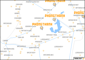
Phong Thạnh (Cà Ma, Vietnam)Phong Thạnh is a town in the Cà Ma region of Vietnam. An overview map of the region around Phong Thạnh is displayed below.
regional and 3d topo map of Phong Thạnh, Vietnam ::
Phong Thạnh airports ::
The nearest airport is SGN - Ho Chi Minh City Tansonnhat Intl, located 230.3 km north east of Phong Thạnh.
Nearby towns ::
Ấp An Hòa (4.0km north west) //
An Trạch (3) (4.3km south west) //
Xóm Ðầu Xấu (4.4km north) //
Tân Lộc (4.6km north) //
Xóm Rạch Giữa (5.0km west) //
Ấp Gò Muồng (5.1km south west) //
Ấp Khúc Tréo (5.3km south east) //
Long Ðiền (1) (5.4km south) //
Khu Vưc (1) (6.5km south) //
Phong Thạnh (6.6km north east) //
Ấp Tân Thuộc (7.0km west) //
Khu Vưc (2) (7.1km south) //
Ðinh Thành (2) (7.6km south west) //
Cầu Tắc Vân (7.6km south west) //
Ấp Bình Ðịnh (7.7km south west) //
Xóm Ba Lét (7.6km south east) //
Xóm Chu Chi (8.2km north) //
Ấp Bến Mã (10.3km north east) //
Long Diền (5) (11.2km south east) //
[all distances 'as the bird flies' and approximate]  Places with similar names to Phong Thạnh, Vietnam ::
Disclaimer :: Information on this page comes without warranty of any kind |
||
|
Where is Phong Thạnh? Elevation and coordinates ::
Latitude (lat): 9°13'45"N Longitude (lon): 105°17'44"E
(map arrows pan, magnifying glasses zoom) |
||
|
Visiting Phong Thạnh? Hotel/Accommodation ::
Book a hotel in Phong Thạnh Travel Guide ::
Buy a travel guide for Vietnam rental cars ::
car rental offers GPS waypoint ::
download a GPX waypoint (PoI) of Phong Thạnh for your GPS receiver
|
||