|
search place name
|
||
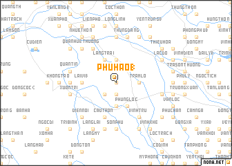
Phú Hào (1) (Thanh Hóa, Vietnam)Phú Hào (1) is a town in the Thanh Hóa region of Vietnam. An overview map of the region around Phú Hào (1) is displayed below.
regional and 3d topo map of Phú Hào (1), Vietnam ::
Phú Hào (1) airports ::
The nearest airport is HAN - Hanoi Noibai Intl, located 153.6 km north of Phú Hào (1).
Nearby towns ::
Mỹ Hào (0.0km north) //
Ðô Xá (0.0km north) //
Quan Thành (1.9km south) //
Tự Thôn (1.9km south) //
Trung Chinh (2.5km south west) //
Cốc Tư (3.7km north) //
Phùng Tác Trung (3.7km south) //
Hoàng Thôn (3.7km south) //
Thiết Cương (3.5km east) //
Trạm Lô (3.5km east) //
Làng Trại (4.1km north west) //
Hà Liên (4.1km south east) //
Phụng Lộc (4.1km south east) //
Lai Vi (1) (5.2km west) //
Diễn Ngoại (1) (5.8km south) //
Quan Châu (5.8km south) //
Cầu Thôn (5.8km south) //
Ðông Nãi (6.6km north west) //
Quả Nhuệ Hạ (6.6km north west) //
Vình Tru (6.6km south east) //
Lạc Lâm (7.0km west) //
Hoanh Cừ (7.0km west) //
Bất Cang (7.4km north) //
Tam Lư (7.4km north) //
Sơn Phú (7.4km south) //
Quần Tín (7.2km west) //
Xuân Trĩ (7.2km west) //
Lân Các (7.6km south) //
Thung Ðang (7.6km north) //
[all distances 'as the bird flies' and approximate] 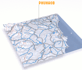 Places with similar names to Phú Hào (1), Vietnam ::
Disclaimer :: Information on this page comes without warranty of any kind |
||
|
Where is Phú Hào (1)? Elevation and coordinates ::
Latitude (lat): 19°51'0"N Longitude (lon): 105°35'0"E
Elevation (approx.): 8m (map arrows pan, magnifying glasses zoom) |
||
|
Visiting Phú Hào (1)? Hotel/Accommodation ::
Book a hotel in Phú Hào (1) Travel Guide ::
Buy a travel guide for Vietnam rental cars ::
car rental offers GPS waypoint ::
download a GPX waypoint (PoI) of Phú Hào (1) for your GPS receiver
|
||