|
search place name
|
||
Phu Long (Vietnam)Phu Long is a town in Vietnam. An overview map of the region around Phu Long is displayed below.
regional and 3d topo map of Phu Long, Vietnam ::

Phu Long airports ::
The nearest airport is SNO - Sakon Nakhon, located 216.3 km south west of Phu Long.
Nearby towns ::
Ðức Nhuân (1.9km north) //
Linh Tai (1.9km north) //
Thanh Liêu (1.9km south) //
Ðại Ðình (1.8km east) //
Thái Bình (1.8km east) //
Khai Hóa (2.6km north west) //
Tiên Hội (2.6km north east) //
Hiên Lãng (2.6km north east) //
Phú Vân (2.6km north east) //
Yên Lac (2.6km south east) //
Dong Du (2.6km south east) //
Thanh Lá (2.6km south east) //
Làng Bo (2.6km south east) //
Phú Van (3.7km north) //
Chơ Rang (3.7km north) //
Xóm Trua (3.7km south) //
La Mac (4.1km north west) //
Cao Diên (4.0km north west) //
Van Chung (4.0km north west) //
Xóm Ðông Giang (4.1km south east) //
An Hôi (4.1km south east) //
Xóm Nhuan Ha (5.1km south east) //
Ði Luân (5.1km south east) //
Thach Sơn (5.1km south east) //
Thương Tho (5.6km north) //
Dông Mỹ (5.6km north) //
Trung Phú Hạ (5.3km east) //
Dai Dong (5.3km east) //
Thanh Chương (5.3km east) //
[all distances 'as the bird flies' and approximate] 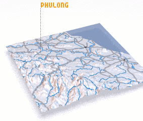 Places with similar names to Phu Long, Vietnam ::
Disclaimer :: Information on this page comes without warranty of any kind |
||
|
Where is Phu Long? Elevation and coordinates ::
Latitude (lat): 18°48'0"N Longitude (lon): 105°17'0"E
Elevation (approx.): 15m (map arrows pan, magnifying glasses zoom) |
||
|
Visiting Phu Long? Hotel/Accommodation ::
Book a hotel in Phu Long Travel Guide ::
Buy a travel guide for Vietnam rental cars ::
car rental offers GPS waypoint ::
download a GPX waypoint (PoI) of Phu Long for your GPS receiver
|
||