|
search place name
|
||
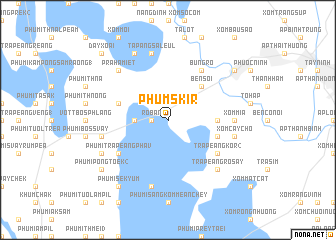
Phum Skir (Tây Ninh, Vietnam)Phum Skir is a town in the Tây Ninh region of Vietnam. An overview map of the region around Phum Skir is displayed below.
regional and 3d topo map of Phum Skir, Vietnam ::
Phum Skir airports ::
The nearest airport is SGN - Ho Chi Minh City Tansonnhat Intl, located 90.3 km south east of Phum Skir.
Other airports nearby include PNH - Phnom-penh Phnom Penh Intl (125.1 km west), Nearby towns ::
Rô Bân (1.8km west) //
Phumĭ Véal (1) (3.6km west) //
Bến Sỏi (5.2km north east) //
Xóm Bố (5.5km east) //
Phumĭ Trâpeăng Thmâ (5.8km west) //
Trapéang Kor (1) (5.8km east) //
Phumĭ Prêk Pôk (5.8km west) //
Phumĭ Trâpeăng Ph'av (6.6km south west) //
Trapéang Kor (2) (6.6km south east) //
Bưng Rồ (6.6km north east) //
Xóm Mía (7.3km east) //
Xóm Cây Chỏ (7.5km east) //
Bŏs Môn Leu (7.5km west) //
Tapang Saleul (7.6km north) //
Phumĭ Léab (7.6km south) //
Trapéang Ro Say (7.8km south east) //
Prahamiệt (7.8km north west) //
Phumĭ Bŏs Toch (8.2km south west) //
Tà Hét (8.3km north west) //
Phumĭ Prey Tayoăn (9.2km south west) //
Phumĭ Sék Yum (9.2km south west) //
Phumĭ Pông Tœ̆k (2) (9.2km south west) //
Ấp Tâm Long (9.2km north east) //
Ðây Xoài (10.4km north west) //
[all distances 'as the bird flies' and approximate] 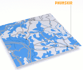 Places with similar names to Phum Skir, Vietnam ::
// Phumĭ Sakôr (KH)
// Phum Sacor (VN)
Disclaimer :: Information on this page comes without warranty of any kind |
||
|
Where is Phum Skir? Elevation and coordinates ::
Latitude (lat): 11°15'0"N Longitude (lon): 105°57'0"E
Elevation (approx.): 8m (map arrows pan, magnifying glasses zoom) |
||
|
Visiting Phum Skir? Hotel/Accommodation ::
Book a hotel in Phum Skir Travel Guide ::
Buy a travel guide for Vietnam rental cars ::
car rental offers GPS waypoint ::
download a GPX waypoint (PoI) of Phum Skir for your GPS receiver
|
||