|
search place name
|
||
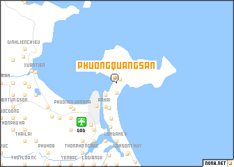
Phường Quang San (Quảng Nam-Ðà Nẵng, Vietnam)Phường Quang San is a town in the Quảng Nam-Ðà Nẵng region of Vietnam. An overview map of the region around Phường Quang San is displayed below.
regional and 3d topo map of Phường Quang San, Vietnam ::
Phường Quang San airports ::
The nearest airport is DAD - Danang Intl, located 8.2 km south west of Phường Quang San.
Nearby towns ::
Khu Phố Nam Thọ (0.8km north east) //
Khu Phố Tân Thái (1.5km south) //
Cô Mân (2.6km south west) //
Khu Triệu Bình (2.6km south west) //
An Hải (4.1km south west) //
Phường Mỹ Thành (4.2km south) //
Ðà Nẵng (4.7km south west) //
Phường An Thương (5.7km south) //
Thồn Mỹ Thi (7.1km south) //
Ấp Ba (7.7km south west) //
Phương Xuân Hòa (7.9km south west) //
Phường Hà Khê (8.0km south west) //
Hòa Khuê (8.2km south west) //
Ấp Hai (8.2km south west) //
Tuyên Hóa (8.2km south west) //
Xóm Nhân Hòa (9.0km south west) //
Thôn Nghi An (10.3km south west) //
[all distances 'as the bird flies' and approximate] 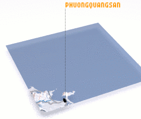 Places with similar names to Phường Quang San, Vietnam :: Disclaimer :: Information on this page comes without warranty of any kind |
||
|
Where is Phường Quang San? Elevation and coordinates ::
Latitude (lat): 16°6'0"N Longitude (lon): 108°15'0"E
Elevation (approx.): 8m (map arrows pan, magnifying glasses zoom) |
||
|
Visiting Phường Quang San? Hotel/Accommodation ::
Book a hotel in Phường Quang San Travel Guide ::
Buy a travel guide for Vietnam rental cars ::
car rental offers GPS waypoint ::
download a GPX waypoint (PoI) of Phường Quang San for your GPS receiver
|
||