|
search place name
|
||
Phú Th (Hải Hưng, Vietnam)Phú Th is a town in the Hải Hưng region of Vietnam. An overview map of the region around Phú Th is displayed below.
regional and 3d topo map of Phú Th, Vietnam ::

Phú Th airports ::
The nearest airport is HAN - Hanoi Noibai Intl, located 37.3 km north of Phú Th.
Nearby towns ::
Bằng Sở (1.7km west) //
Nình Xá (1.7km west) //
Xâm Khố (1.9km south) //
Ðan Kim (2.5km north east) //
Xóm Ngoa (2.5km north west) //
Ðông Phù Liệt (2.5km north west) //
Xóm Dong (2.5km north west) //
Chương Lộc (3.7km south) //
Chử Xá (3.7km north) //
Ðông Tảo Dông (3.5km east) //
Phúc Am (3.5km west) //
Cong Luận (4.1km north east) //
Ðông Thai (4.1km south west) //
Ðông Trạch (3.9km north west) //
Yên Vĩnh (5.1km south east) //
Phú Cốc (5.1km south west) //
Chương Dương (5.6km south) //
Tự Nhiên Châu (5.6km south) //
Tương Truc (5.5km west) //
Van Trai (6.4km south west) //
Lại Ốc (6.4km north east) //
Hòa Bình (6.4km north east) //
Duc Trach (6.6km south west) //
Dồng Trì (6.5km north west) //
Ðại Hạnh (6.9km east) //
Kiến Châu (7.4km south) //
Kim Quan (7.4km north) //
Xuân Quan (7.4km north) //
Bình Phú (7.2km east) //
[all distances 'as the bird flies' and approximate] 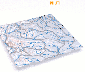 Places with similar names to Phú Th, Vietnam ::
Disclaimer :: Information on this page comes without warranty of any kind |
||
|
Where is Phú Th? Elevation and coordinates ::
Latitude (lat): 20°54'0"N Longitude (lon): 105°55'0"E
Elevation (approx.): 8m (map arrows pan, magnifying glasses zoom) |
||
|
Visiting Phú Th? Hotel/Accommodation ::
Book a hotel in Phú Th Travel Guide ::
Buy a travel guide for Vietnam rental cars ::
car rental offers GPS waypoint ::
download a GPX waypoint (PoI) of Phú Th for your GPS receiver
|
||