|
search place name
|
||
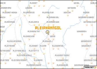
Plei Pham Ngơl (Vietnam)Plei Pham Ngơl is a town in Vietnam. An overview map of the region around Plei Pham Ngơl is displayed below.
regional and 3d topo map of Plei Pham Ngơl, Vietnam ::
Plei Pham Ngơl airports ::
The nearest airport is NHA - Nhatrang, located 211.0 km south east of Plei Pham Ngơl.
Nearby towns ::
Plei Pham Kléo (0.0km north) //
Dè Ko Drah (2) (1.8km east) //
Plei Poui (1.9km south) //
Plei Lim (2.6km south east) //
Dè Nia (2.6km south east) //
Plei Loutte (3.7km north) //
Plei Djirl (2) (3.7km south) //
Plei Pham Gua (4.1km north east) //
Plei Hlu Klah (5.2km north west) //
Plei Mơnu Tat (5.4km west) //
Plei Mơnu Dooch (5.4km west) //
Plei Brêng (5.4km west) //
Plei Pham Kol (5.8km north) //
Plei Bia Anet (1) (5.8km north) //
Dè Poui (5.8km south) //
Plei Pâ (5.8km south) //
Plei Lê Anh (6.5km north west) //
Plei Dap Rao (6.6km south east) //
Plei Ngleum (7.4km north) //
Plei Ho Cham (7.4km west) //
Dè Bloutte Chorr (7.6km south) //
Plei Ho By (7.8km south west) //
Plei Dông Lâm (8.2km north west) //
Plei Tôtt (3) (9.2km south west) //
Plei Hô Teng Lao (9.2km south west) //
De Klah (10.3km north east) //
Plei Poo Ngo (10.3km north west) //
La Sơn (2) (10.3km north west) //
[all distances 'as the bird flies' and approximate]  Places with similar names to Plei Pham Ngơl, Vietnam :: Disclaimer :: Information on this page comes without warranty of any kind |
||
|
Where is Plei Pham Ngơl? Elevation and coordinates ::
Latitude (lat): 13°49'0"N Longitude (lon): 108°7'0"E
Elevation (approx.): 678m (map arrows pan, magnifying glasses zoom) |
||
|
Visiting Plei Pham Ngơl? Hotel/Accommodation ::
Book a hotel in Plei Pham Ngơl Travel Guide ::
Buy a travel guide for Vietnam rental cars ::
car rental offers GPS waypoint ::
download a GPX waypoint (PoI) of Plei Pham Ngơl for your GPS receiver
|
||