|
search place name
|
||
Plei Totung (Vietnam)Plei Totung is a town in Vietnam. An overview map of the region around Plei Totung is displayed below.
regional and 3d topo map of Plei Totung, Vietnam ::

Plei Totung airports ::
The nearest airport is DAD - Danang Intl, located 217.2 km north of Plei Totung.
Other airports nearby include NHA - Nhatrang (221.0 km south), Nearby towns ::
Plei Sao (0.0km north) //
De Dong (1) (1.9km south) //
Kon Djiran Ye (1.9km north) //
Plei Ser Tor (2.6km south west) //
Plei Kolang (6.5km south east) //
Plei Tamui (4) (7.2km east) //
De Latang Ye (1) (7.4km north) //
De Latang Ye (2) (7.6km north) //
Le Kan (7.4km east) //
Plei Kor Trang (1) (7.7km north east) //
Blang N'long (8.1km south east) //
Plei Brang Klah (1) (8.2km south east) //
Kon Klun Ye (9.2km north west) //
[all distances 'as the bird flies' and approximate] 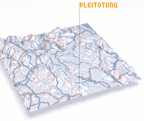 Places with similar names to Plei Totung, Vietnam ::
// Poltādānga (BD)
Disclaimer :: Information on this page comes without warranty of any kind |
||
|
Where is Plei Totung? Elevation and coordinates ::
Latitude (lat): 14°6'0"N Longitude (lon): 108°29'0"E
Elevation (approx.): 1048m (map arrows pan, magnifying glasses zoom) |
||
|
Visiting Plei Totung? Hotel/Accommodation ::
Book a hotel in Plei Totung Travel Guide ::
Buy a travel guide for Vietnam rental cars ::
car rental offers GPS waypoint ::
download a GPX waypoint (PoI) of Plei Totung for your GPS receiver
|
||