|
search place name
|
||
Pó Ðôn (Lạng Sơn, Vietnam)Pó Ðôn is a town in the Lạng Sơn region of Vietnam. An overview map of the region around Pó Ðôn is displayed below.
regional and 3d topo map of Pó Ðôn, Vietnam ::

Pó Ðôn airports ::
The nearest airport is HAN - Hanoi Noibai Intl, located 114.2 km south west of Pó Ðôn.
Other airports nearby include NNG - Nanning Wuxu (175.6 km north east), Nearby towns ::
Bản Khinh (1.9km north) //
Khánh Khê (2.5km north west) //
Khuông Cồc (2.5km north west) //
Lũng Uât (3.7km north) //
Khuổi Mia (3.4km east) //
Văn Giáp (3.9km south east) //
Nà Kinh (4.1km south east) //
Nà Rẻ (5.1km south west) //
Tèng Cha (5.6km north) //
Nà Pia (5.6km north) //
Bản Nhầng (5.2km east) //
Bản Lan (5.5km west) //
Bản Nang (6.4km south west) //
Khao Cất (6.4km south east) //
Quan Ho (7.1km east) //
Văn Quan (7.1km west) //
Ðiềm He (7.1km west) //
Thâm Lũng (7.6km north east) //
Nà Mẫn (8.2km north east) //
Cản Nông (8.2km north west) //
Lạng Sơn (7.8km south east) //
Quảng Nhân (7.8km south east) //
Chu Quyển (8.8km north east) //
Quy Hậu (9.0km south west) //
Ba Xã (9.0km south west) //
Nà Ro (8.8km north west) //
Khôn Pen (8.8km south west) //
Quảng Cư (9.0km south east) //
[all distances 'as the bird flies' and approximate] 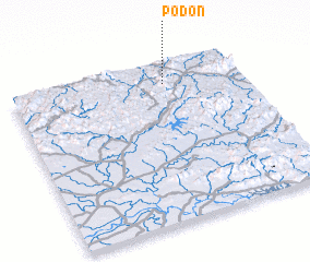 Places with similar names to Pó Ðôn, Vietnam ::
Disclaimer :: Information on this page comes without warranty of any kind |
||
|
Where is Pó Ðôn? Elevation and coordinates ::
Latitude (lat): 21°52'0"N Longitude (lon): 106°40'0"E
Elevation (approx.): 380m (map arrows pan, magnifying glasses zoom) |
||
|
Visiting Pó Ðôn? Hotel/Accommodation ::
Book a hotel in Pó Ðôn Travel Guide ::
Buy a travel guide for Vietnam rental cars ::
car rental offers GPS waypoint ::
download a GPX waypoint (PoI) of Pó Ðôn for your GPS receiver
|
||