|
search place name
|
||
Rũng Nghĩa (Thái Bình, Vietnam)Rũng Nghĩa is a town in the Thái Bình region of Vietnam. An overview map of the region around Rũng Nghĩa is displayed below.
regional and 3d topo map of Rũng Nghĩa, Vietnam ::

Rũng Nghĩa airports ::
The nearest airport is HAN - Hanoi Noibai Intl, located 108.4 km north west of Rũng Nghĩa.
Nearby towns ::
Thái Nghĩa (1.7km west) //
Tan Phong (1.7km west) //
La Xuyên (1.9km north) //
Ðức Long (1.9km south) //
Thái Phú (2.5km south west) //
Tù Quán (3.5km west) //
Bac Tiên Trai (3.5km east) //
Nam Hà (3.9km north west) //
Bồng Tiên (4.1km north east) //
An Lãng (4.1km south east) //
Dương A Lương (5.1km north west) //
An Phú (5.1km north east) //
Ngọc Cục (5.1km south east) //
Phương Dễ (5.6km south) //
Ðại An (5.8km north) //
Nam Ninh (5.8km south) //
Cao Lộng (5.5km west) //
Hưng Nghĩa (5.5km west) //
Kiến Xá (5.8km north) //
Phương Khê (5.8km south) //
HạcChâu (5.5km east) //
Vân Môn (5.5km east) //
Trung Lao (6.6km south west) //
Ngọc Tỉnh (6.6km south west) //
Cổ Việt (6.6km north east) //
Phứ Thọ (6.6km south east) //
Cổ Gia (7.0km west) //
Lịch Ðông (7.4km south) //
Cổ Chử (7.2km west) //
[all distances 'as the bird flies' and approximate] 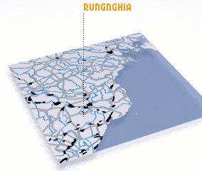 Places with similar names to Rũng Nghĩa, Vietnam :: Disclaimer :: Information on this page comes without warranty of any kind |
||
|
Where is Rũng Nghĩa? Elevation and coordinates ::
Latitude (lat): 20°21'0"N Longitude (lon): 106°17'0"E
Elevation (approx.): 3m (map arrows pan, magnifying glasses zoom) |
||
|
Visiting Rũng Nghĩa? Hotel/Accommodation ::
Book a hotel in Rũng Nghĩa Travel Guide ::
Buy a travel guide for Vietnam rental cars ::
car rental offers GPS waypoint ::
download a GPX waypoint (PoI) of Rũng Nghĩa for your GPS receiver
|
||