|
search place name
|
||
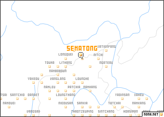
Se Ma Tong (Vietnam)Se Ma Tong is a town in Vietnam. An overview map of the region around Se Ma Tong is displayed below.
regional and 3d topo map of Se Ma Tong, Vietnam ::
Se Ma Tong airports ::
The nearest airport is HAN - Hanoi Noibai Intl, located 241.0 km south east of Se Ma Tong.
Nearby towns ::
Lao Tao Chay (0.0km north) //
Lao Pao Tchai (2.5km north west) //
Sin Tchay (2.5km south east) //
Koung Loung (2.5km south east) //
Ni Tchi (3.4km east) //
Long Quei (3.4km west) //
Mao Teao Tchay (4.1km south west) //
Li Thang (3.9km south west) //
Keou Hoi (5.6km south) //
Loung He (5.6km south) //
Sia Tien Fang (5.4km east) //
Pha Long (5.4km east) //
Nga Teau (5.5km east) //
Ho To Tchai (5.5km west) //
Kao Kang (5.8km south) //
Nam Bo Boun (6.3km south west) //
Keau Nà (6.5km south west) //
Com Mao (7.6km south) //
Nam Hang (7.6km south) //
Pa Tchia (7.6km south) //
Tou Ma (7.1km west) //
Vang Lang (7.6km south west) //
Na Ka (8.2km south west) //
Nam Do (9.0km south west) //
Nam Leu (10.1km south west) //
[all distances 'as the bird flies' and approximate] 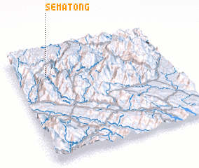 Places with similar names to Se Ma Tong, Vietnam ::
// Samadang (MM)
// Samdang (MM)
// Sam-tang (MM)
// Ciemiętniki (PL)
// Śmietanki (PL)
// Cimdenieki (LV)
// Samétienga (BF)
// Samtenga (BF)
// Sèmtenga (BF)
// Samudongo (CD)
Disclaimer :: Information on this page comes without warranty of any kind |
||
|
Where is Se Ma Tong? Elevation and coordinates ::
Latitude (lat): 22°48'0"N Longitude (lon): 104°12'0"E
Elevation (approx.): 1233m (map arrows pan, magnifying glasses zoom) |
||
|
Visiting Se Ma Tong? Hotel/Accommodation ::
Book a hotel in Se Ma Tong Travel Guide ::
Buy a travel guide for Vietnam rental cars ::
car rental offers GPS waypoint ::
download a GPX waypoint (PoI) of Se Ma Tong for your GPS receiver
|
||