|
search place name
|
||
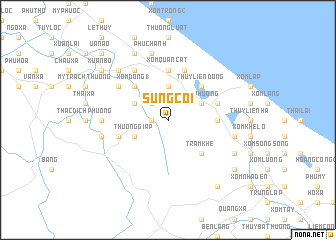
Sung Côi (Vietnam)Sung Côi is a town in Vietnam. An overview map of the region around Sung Côi is displayed below.
regional and 3d topo map of Sung Côi, Vietnam ::
Sung Côi airports ::
The nearest airport is DAD - Danang Intl, located 186.3 km south east of Sung Côi.
Nearby towns ::
Thượng Lâm (1.8km west) //
Nang Doãn (1.8km west) //
Thái Xá (1.8km west) //
Ấp An Lão (2.6km north west) //
Trung Lực (3.7km north) //
Thượng Giáp (4.0km south west) //
Hạ Giáp (4.0km north west) //
Thủy Liên Thượng (4.0km north east) //
Xóm Phương (4.0km north east) //
Xóm Ðông (1) (5.1km north west) //
Mỹ Trạch (5.1km north west) //
Tram Khe (5.1km south east) //
Thủy Liên Ðông (5.1km north east) //
Quán Mói (5.3km east) //
Xóm Quàn Cát (5.6km north) //
Cỗ Liễu Phường (5.6km west) //
Thủy Liên Hạ (5.6km east) //
Phú Thiết (5.8km north) //
Liêm Thiện (6.5km north west) //
Mỹ Thổ (6.6km north west) //
Qui Hậu Phường (7.1km west) //
Phương Tiễu (7.3km west) //
Phù Chánh (7.6km north) //
Quán Bụt (7.3km east) //
Thuận Trạch (7.7km north west) //
Mỹ Hòa (7.7km north west) //
Dương Xá (7.7km north west) //
Thủy Liên Nam Giáp (8.0km south east) //
Quan Tây (8.0km south east) //
[all distances 'as the bird flies' and approximate] 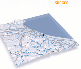 Places with similar names to Sung Côi, Vietnam ::
Disclaimer :: Information on this page comes without warranty of any kind |
||
|
Where is Sung Côi? Elevation and coordinates ::
Latitude (lat): 17°9'0"N Longitude (lon): 106°53'0"E
Elevation (approx.): 18m (map arrows pan, magnifying glasses zoom) |
||
|
Visiting Sung Côi? Hotel/Accommodation ::
Book a hotel in Sung Côi Travel Guide ::
Buy a travel guide for Vietnam rental cars ::
car rental offers GPS waypoint ::
download a GPX waypoint (PoI) of Sung Côi for your GPS receiver
|
||