|
search place name
|
||
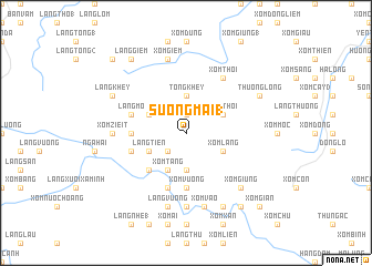
Sương Mai (1) (Vĩnh Phú, Vietnam)Sương Mai (1) is a town in the Vĩnh Phú region of Vietnam. An overview map of the region around Sương Mai (1) is displayed below.
regional and 3d topo map of Sương Mai (1), Vietnam ::
Sương Mai (1) airports ::
The nearest airport is HAN - Hanoi Noibai Intl, located 91.1 km east of Sương Mai (1).
Nearby towns ::
Sương Mai (2) (1.9km north) //
Thu Cúc (2.5km south west) //
Tong Khey (3.7km north) //
Xóm Câu (3.7km south) //
Xóm Bốn (4.1km south west) //
Xóm Tăng (4.1km south west) //
Làng Tho (2) (3.9km north west) //
Làng Tien (3.9km south west) //
Xóm Thói (3.9km north east) //
Xóm Lầng (3.9km south east) //
Xóm Ôu (5.1km south west) //
Xóm Giác (5.1km south west) //
Làng Con (1) (5.2km west) //
Xóm Vương (5.6km south) //
Xóm Ban (5.8km south) //
Làng Mo (5.5km west) //
Làng Con (2) (5.5km west) //
Xóm Thới (6.5km north east) //
Xóm Zieit (6.9km west) //
Làng Queué (6.9km west) //
Làng Kiêng (1) (7.4km south) //
Làng Phật (7.6km south) //
Làng Vướng (7.6km south) //
Xóm Giem (7.6km north) //
Làng Kiệt Sơn (7.6km south) //
Xóm Vào (7.6km south) //
Xóm Giung (7.6km south east) //
Làng Khey (7.8km north west) //
Thượng Long (7.8km north east) //
[all distances 'as the bird flies' and approximate] 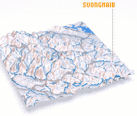 Places with similar names to Sương Mai (1), Vietnam ::
// Sengama (1) (LR)
// Sangmuba (CN)
Disclaimer :: Information on this page comes without warranty of any kind |
||
|
Where is Sương Mai (1)? Elevation and coordinates ::
Latitude (lat): 21°18'0"N Longitude (lon): 104°56'0"E
Elevation (approx.): 447m (map arrows pan, magnifying glasses zoom) |
||
|
Visiting Sương Mai (1)? Hotel/Accommodation ::
Book a hotel in Sương Mai (1) Travel Guide ::
Buy a travel guide for Vietnam rental cars ::
car rental offers GPS waypoint ::
download a GPX waypoint (PoI) of Sương Mai (1) for your GPS receiver
|
||