|
search place name
|
||
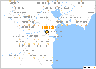
Tấn Tài (Vietnam)Tấn Tài is a town in Vietnam. An overview map of the region around Tấn Tài is displayed below.
regional and 3d topo map of Tấn Tài, Vietnam ::
Tấn Tài airports ::
The nearest airport is NHA - Nhatrang, located 77.8 km north of Tấn Tài.
Nearby towns ::
Thôn Tấn Lộc (0.0km north) //
Kinh Dinh (1.9km north) //
Thôn An Thạnh (1.9km south) //
Thôn Mỹ Nghĩa (1.8km east) //
Phan Rang-Tháp Chàm (2.6km north west) //
Thôn Mỹ Phước (2.6km north east) //
Thôn Hải Chữ (3.6km east) //
Thôn Tây Giang (3.6km east) //
Thôn Thành Hòa (3.6km east) //
Thôn Ðông Giang (3.6km east) //
Lâu Tú (3.7km south) //
Thôn Thuận Hòa (4.1km north west) //
Ấp Long Thạnh (4.1km south west) //
Thôn Phú Thọ (4.1km south east) //
Bắc Sớn (4.1km north east) //
Thôn Phước Ðức (5.2km north west) //
Thôn Mỹ Ðức (5.2km north west) //
Thôn Từ Tâm (5.2km south west) //
Thôn Bình Quý (5.8km west) //
Thôn Tân Hội (5.8km north) //
Thôn Thành Tin (5.8km south) //
Thôn Nhơn Sơn (6.6km north east) //
Thôn Dư Khánh (6.6km north east) //
Thôn Bảo An (6.6km north west) //
Thôn Khánh Hội (6.6km north east) //
Thôn Ninh Chữ (6.6km north east) //
Thanh Hải (6.6km north east) //
Thôn Hà Thủy (6.6km south west) //
Thôn Mỹ Nghiệp (6.6km south west) //
[all distances 'as the bird flies' and approximate]  Places with similar names to Tấn Tài, Vietnam ::
Disclaimer :: Information on this page comes without warranty of any kind |
||
|
Where is Tấn Tài? Elevation and coordinates ::
Latitude (lat): 11°33'0"N Longitude (lon): 109°0'0"E
Elevation (approx.): 5m (map arrows pan, magnifying glasses zoom) |
||
|
Visiting Tấn Tài? Hotel/Accommodation ::
Book a hotel in Tấn Tài Travel Guide ::
Buy a travel guide for Vietnam rental cars ::
car rental offers GPS waypoint ::
download a GPX waypoint (PoI) of Tấn Tài for your GPS receiver
|
||