|
search place name
|
||
Ta Ya Kao (Lai Châu, Vietnam)Ta Ya Kao is a town in the Lai Châu region of Vietnam. An overview map of the region around Ta Ya Kao is displayed below.
regional and 3d topo map of Ta Ya Kao, Vietnam ::

Nearby towns ::
Ma Qua Thang (1.9km north) //
Nieu Tao Phung (1.9km north) //
Long Cou (2.5km north east) //
Nam Long (3.4km east) //
Hung Thou Tiai (3.7km north) //
San Tiai Po (4.1km south east) //
Tung Tiai (3.9km north east) //
Ta Tiai (3.9km north east) //
Sin Pao Tiai (3.9km north east) //
Sin Tiai (4.1km north east) //
Nung Nang (5.0km south east) //
Can Ho (5.0km north east) //
Na Ngô (5.1km east) //
To Y Pin (5.6km north) //
Tan Sao Pin (5.8km north) //
Soui Tao (5.5km east) //
Tien Po (5.8km north) //
Nung Nang (6.3km south east) //
Sai San (6.3km south east) //
Nieu Sang (6.5km north east) //
Yao Ngai Tiai (6.3km north east) //
Ngai Chò (7.4km north) //
Ta Lan Than (7.1km east) //
Nam San (7.1km east) //
Ta Su Tio (7.6km north east) //
Can Ti (7.6km north west) //
Lao Tì Pong (7.8km south east) //
Nhi Duong (7.8km north east) //
Sa Yin Cao (7.8km north east) //
[all distances 'as the bird flies' and approximate] 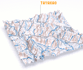 Places with similar names to Ta Ya Kao, Vietnam ::
Disclaimer :: Information on this page comes without warranty of any kind |
||
|
Where is Ta Ya Kao? Elevation and coordinates ::
Latitude (lat): 22°24'0"N Longitude (lon): 103°24'0"E
Elevation (approx.): 862m (map arrows pan, magnifying glasses zoom) |
||
|
Visiting Ta Ya Kao? Hotel/Accommodation ::
Book a hotel in Ta Ya Kao Travel Guide ::
Buy a travel guide for Vietnam rental cars ::
car rental offers GPS waypoint ::
download a GPX waypoint (PoI) of Ta Ya Kao for your GPS receiver
|
||