|
search place name
|
||
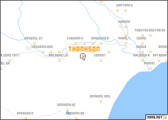
Thanh Sơn (Vietnam)Thanh Sơn is a town in Vietnam. An overview map of the region around Thanh Sơn is displayed below.
regional and 3d topo map of Thanh Sơn, Vietnam ::
Thanh Sơn airports ::
The nearest airport is NHA - Nhatrang, located 142.1 km north east of Thanh Sơn.
Other airports nearby include SGN - Ho Chi Minh City Tansonnhat Intl (198.8 km west), Nearby towns ::
Ðống Trên (2.6km north east) //
Ấp Hiệp An (3.7km north) //
Xóm Rẩy (3.6km east) //
Ấp Thanh Châu (4.1km north west) //
Châu Hành (4.1km north west) //
Ấp Tân Bình (4.1km north east) //
Ấp Hiệp Hòa (5.2km north east) //
Ấp Lương Lợi (5.5km west) //
Ngọc Sơn (5.8km east) //
Ấp Lương Bình (5.8km west) //
Ấp Lương Tây (1) (7.5km west) //
[all distances 'as the bird flies' and approximate] 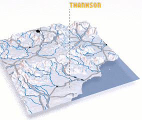 Places with similar names to Thanh Sơn, Vietnam ::
Disclaimer :: Information on this page comes without warranty of any kind |
||
|
Where is Thanh Sơn? Elevation and coordinates ::
Latitude (lat): 11°11'0"N Longitude (lon): 108°26'0"E
Elevation (approx.): 77m (map arrows pan, magnifying glasses zoom) |
||
|
Visiting Thanh Sơn? Hotel/Accommodation ::
Book a hotel in Thanh Sơn Travel Guide ::
Buy a travel guide for Vietnam rental cars ::
car rental offers GPS waypoint ::
download a GPX waypoint (PoI) of Thanh Sơn for your GPS receiver
|
||