|
search place name
|
||
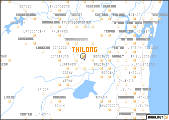
Thị Long (Thanh Hóa, Vietnam)Thị Long is a town in the Thanh Hóa region of Vietnam. An overview map of the region around Thị Long is displayed below.
regional and 3d topo map of Thị Long, Vietnam ::
Thị Long airports ::
The nearest airport is HAN - Hanoi Noibai Intl, located 185.5 km north of Thị Long.
Nearby towns ::
Ðồng Phú (1.7km west) //
Lộc Tuy (1.9km north) //
Thái Tượng (1.7km east) //
Hoàng Phổ (1.9km south) //
Hân Áng (2.5km north west) //
Thái Yên (2.5km south west) //
Khả Lam (2.5km south east) //
Ðạo Thôn (2.5km south east) //
Bồng Thôn (3.5km east) //
Thượng Ðu Ðông (4.1km north west) //
Luật Thôn (4.0km south west) //
Long Vực (4.1km north east) //
Thọ Nga (4.1km north east) //
Trúc Thôn (4.0km south east) //
Khang Ninh (5.1km north west) //
Cấp Kỹ (5.1km south west) //
Ðồng Nạc (5.1km south east) //
Ðồng Trung (5.2km west) //
Cự Phú (5.2km west) //
Cổ Trinh (5.2km east) //
Quang Quí (5.6km east) //
Ðồng Ðạo (5.6km west) //
Lạn Thôn (5.6km east) //
Bài Liệt (5.6km east) //
Yên Mỹ (6.6km south west) //
Song Thôn (6.4km south east) //
Phú Ða Hậu (6.6km north east) //
Ðông Lý (7.0km east) //
Phu Nẫm (7.4km north) //
[all distances 'as the bird flies' and approximate] 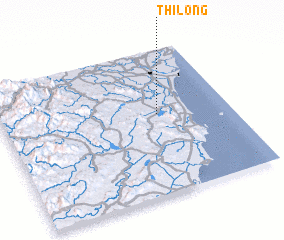 Places with similar names to Thị Long, Vietnam ::
Disclaimer :: Information on this page comes without warranty of any kind |
||
|
Where is Thị Long? Elevation and coordinates ::
Latitude (lat): 19°33'0"N Longitude (lon): 105°41'0"E
Elevation (approx.): 76m (map arrows pan, magnifying glasses zoom) |
||
|
Visiting Thị Long? Hotel/Accommodation ::
Book a hotel in Thị Long Travel Guide ::
Buy a travel guide for Vietnam rental cars ::
car rental offers GPS waypoint ::
download a GPX waypoint (PoI) of Thị Long for your GPS receiver
|
||