|
search place name
|
||
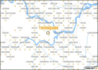
Thịnh Quả (1) (Vietnam)Thịnh Quả (1) is a town in Vietnam. An overview map of the region around Thịnh Quả (1) is displayed below.
regional and 3d topo map of Thịnh Quả (1), Vietnam ::
Thịnh Quả (1) airports ::
The nearest airport is SNO - Sakon Nakhon, located 218.4 km south west of Thịnh Quả (1).
Nearby towns ::
Tương Xá (0.0km north) //
Long Xuyen (1.9km north) //
Hung Nhân (1.9km north) //
Phố Ðồng (1.9km north) //
Thịnh Quả (2) (1.9km south) //
Quảng Xá (2.6km north west) //
Thượng Truy (2.6km north west) //
Yên Cu (1) (2.6km north east) //
Van Hoi (2.6km south west) //
Thọ Tường (2.6km south west) //
Lang Ngạn (2.6km south east) //
Xóm Tam Lăng (3.5km west) //
Tòng Sơn (3.7km north) //
Phu Xa (3.7km north) //
Khanh Sơn (3.5km east) //
Quang Giu (3.5km east) //
Hiệu Mỹ (3.5km east) //
Tho Ninh (3.7km south) //
Cửu Yên (4.0km south west) //
Xóm Vĩnh Khanh (4.1km north west) //
Yên Trung (4.1km south west) //
Ðưc Thọ (4.1km south west) //
Xóm Phuc Ðinh (5.1km north west) //
Ðông Viên (5.1km north west) //
Yên Thái (5.1km north east) //
Yên Hôi (5.1km south west) //
Yèn Thọ (5.1km south east) //
Yên Vưc (5.3km west) //
Yên Sơn (5.3km west) //
[all distances 'as the bird flies' and approximate] 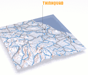 Places with similar names to Thịnh Quả (1), Vietnam ::
Disclaimer :: Information on this page comes without warranty of any kind |
||
|
Where is Thịnh Quả (1)? Elevation and coordinates ::
Latitude (lat): 18°34'0"N Longitude (lon): 105°36'0"E
Elevation (approx.): 4m (map arrows pan, magnifying glasses zoom) |
||
|
Visiting Thịnh Quả (1)? Hotel/Accommodation ::
Book a hotel in Thịnh Quả (1) Travel Guide ::
Buy a travel guide for Vietnam rental cars ::
car rental offers GPS waypoint ::
download a GPX waypoint (PoI) of Thịnh Quả (1) for your GPS receiver
|
||