|
search place name
|
||
Thôn Cử Lại (Vietnam)Thôn Cử Lại is a town in Vietnam. An overview map of the region around Thôn Cử Lại is displayed below.
regional and 3d topo map of Thôn Cử Lại, Vietnam ::

Thôn Cử Lại airports ::
The nearest airport is DAD - Danang Intl, located 74.8 km south east of Thôn Cử Lại.
Other airports nearby include PKZ - Pakse (258.9 km south west), Nearby towns ::
Thôn An Dương (1.8km west) //
Thôn Kế Sung (2.6km south east) //
Thôn Xuân Ổ (2) (4.1km south west) //
Thôn Mỹ Khánh (5.1km south east) //
Thôn Xuân Ổ (5.1km south west) //
Thôn Quảng Xuyên (5.6km south) //
Dông Lộc (5.8km south) //
Thôn Thái Dương Hạ (1) (5.6km west) //
Thôn Phương Diên (6.6km south east) //
Ấp Ðồng Gi (6.6km south west) //
Thôn Vĩnh Lưu (7.4km south) //
Thôn Ba Lăng (7.4km south) //
Thôn Lê Xá Ðông (7.6km south) //
Phương Diên (7.7km south east) //
Thôn Vinh Mai (8.2km south east) //
Thôn Tân Sa (9.1km south east) //
Thôn Kế Võ (9.1km south east) //
Ấp Ðồng Thanh (9.1km south west) //
Thôn Vân Thê (9.0km south west) //
Thôn Xuân Thiên Thượng (10.3km south east) //
Ấp Sư Lỗ Thượng (10.3km south west) //
[all distances 'as the bird flies' and approximate] 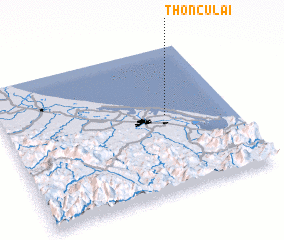 Places with similar names to Thôn Cử Lại, Vietnam ::
// Thanukalaw (MM)
// Thaungle (MM)
// The Angle (US)
// Thinglei (MM)
// Thộng Lưu (VN)
// Thôn Cổ Lủy (VN)
// Thôn Cù Lao (VN)
// Thôn Quy Lai (VN)
// Thương Lệ (VN)
// Thuong Lo (VN)
Disclaimer :: Information on this page comes without warranty of any kind |
||
|
Where is Thôn Cử Lại? Elevation and coordinates ::
Latitude (lat): 16°32'0"N Longitude (lon): 107°43'0"E
Elevation (approx.): -32768m (map arrows pan, magnifying glasses zoom) |
||
|
Visiting Thôn Cử Lại? Hotel/Accommodation ::
Book a hotel in Thôn Cử Lại Travel Guide ::
Buy a travel guide for Vietnam rental cars ::
car rental offers GPS waypoint ::
download a GPX waypoint (PoI) of Thôn Cử Lại for your GPS receiver
|
||