|
search place name
|
||
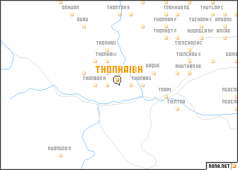
Thôn Hai (17) (Quảng Nam-Ðà Nẵng, Vietnam)Thôn Hai (17) is a town in the Quảng Nam-Ðà Nẵng region of Vietnam. An overview map of the region around Thôn Hai (17) is displayed below.
regional and 3d topo map of Thôn Hai (17), Vietnam ::
Thôn Hai (17) airports ::
The nearest airport is DAD - Danang Intl, located 77.0 km north of Thôn Hai (17).
Nearby towns ::
Thôn Một (8) (1.8km east) //
Thôn Ba (7) (1.9km north) //
Thôn Bốn (8) (1.8km west) //
Thôn Bốn (9) (2.6km north west) //
Mau Long (3.6km east) //
Thôn Ba (6) (3.6km east) //
Thôn Bốn (7) (3.6km west) //
Thôn Hai (9) (4.1km north west) //
Thôn Bốn (15) (5.1km north west) //
Thôn Ba (9) (5.1km north west) //
Da Que (5.7km east) //
Thôn Hai (8) (5.8km north) //
Taboa (5.8km north) //
Thôn Bốn (10) (5.7km west) //
Dương Hòa Thượng (7.4km east) //
Trà Mi (7.4km east) //
Thôn Một (5) (10.3km north east) //
[all distances 'as the bird flies' and approximate] 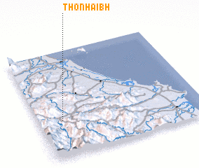 Places with similar names to Thôn Hai (17), Vietnam ::
// Thôn Hai (1) (VN)
// Thôn Hai (1) (VN)
// Thôn Hai (1) (VN)
// Thuận Hòa (1) (VN)
// Thuận Hòa (1) (VN)
Disclaimer :: Information on this page comes without warranty of any kind |
||
|
Where is Thôn Hai (17)? Elevation and coordinates ::
Latitude (lat): 15°21'0"N Longitude (lon): 108°9'0"E
Elevation (approx.): 227m (map arrows pan, magnifying glasses zoom) |
||
|
Visiting Thôn Hai (17)? Hotel/Accommodation ::
Book a hotel in Thôn Hai (17) Travel Guide ::
Buy a travel guide for Vietnam rental cars ::
car rental offers GPS waypoint ::
download a GPX waypoint (PoI) of Thôn Hai (17) for your GPS receiver
|
||