|
search place name
|
||
Thuận Lệ (Vietnam)Thuận Lệ is a town in Vietnam. An overview map of the region around Thuận Lệ is displayed below.
regional and 3d topo map of Thuận Lệ, Vietnam ::

Thuận Lệ airports ::
The nearest airport is ZVK - Savannakhet, located 228.9 km south west of Thuận Lệ.
Other airports nearby include SNO - Sakon Nakhon (234.7 km south west), Nearby towns ::
Thượng Thọ (1.8km east) //
Giu Lạc (1.8km east) //
Thượng Lộc (1.9km south) //
Xóm Vưc (1.8km west) //
Am Th (1.9km north) //
Ðông Lạc (2.6km south east) //
Tuy Lộc (2.6km south west) //
Lại Trung (2.6km north west) //
Nhân Mỹ (3.5km east) //
Am Hạ Ðiếm (3.7km north) //
Lạc Hạ (4.0km north east) //
Cầu Thượng (4.0km north east) //
Kim Nặc (4.0km north west) //
Xóm Mói (5.1km north east) //
Cầu Ðá (5.1km north east) //
Quyên Dông (5.1km north east) //
Xóm Ðào (5.1km north east) //
Lai Lộc (5.1km north west) //
Xuân Lộc (5.6km north) //
Lại Lộc (6.5km south east) //
Bồi Hoa (6.5km north west) //
Ðan Xuyên (6.5km north east) //
Hòa Dục (6.5km north east) //
Thổ Ngọa (6.5km north west) //
Vân Ðôn (6.5km north west) //
Tú Dụng (7.0km east) //
Văn Thái Thôn (7.3km east) //
Thiện Tri (7.6km north) //
Hưng Long (7.6km north) //
[all distances 'as the bird flies' and approximate] 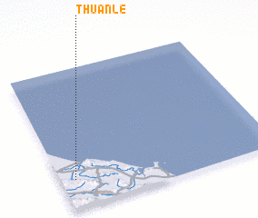 Places with similar names to Thuận Lệ, Vietnam ::
Disclaimer :: Information on this page comes without warranty of any kind |
||
|
Where is Thuận Lệ? Elevation and coordinates ::
Latitude (lat): 18°12'0"N Longitude (lon): 106°4'0"E
Elevation (approx.): 11m (map arrows pan, magnifying glasses zoom) |
||
|
Visiting Thuận Lệ? Hotel/Accommodation ::
Book a hotel in Thuận Lệ Travel Guide ::
Buy a travel guide for Vietnam rental cars ::
car rental offers GPS waypoint ::
download a GPX waypoint (PoI) of Thuận Lệ for your GPS receiver
|
||