|
search place name
|
||
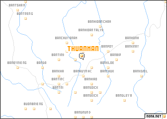
Thuần Mẫn (Ðắc Lắk, Vietnam)Thuần Mẫn is a town in the Ðắc Lắk region of Vietnam. An overview map of the region around Thuần Mẫn is displayed below.
regional and 3d topo map of Thuần Mẫn, Vietnam ::
Thuần Mẫn airports ::
The nearest airport is NHA - Nhatrang, located 149.0 km south east of Thuần Mẫn.
Nearby towns ::
Ban Bek (1.9km north) //
Ban Hoaï (2) (1.8km west) //
Ban Huynh (3) (2.6km south east) //
Ban Huynh (2) (3.7km south) //
Ban Krang (4.1km north west) //
Ban Chư Ya Nam (5.2km north west) //
Ban Tir (1) (5.4km west) //
Ban Kloê (5.7km east) //
Ban Poy (5.7km east) //
Ban Hioan Taly (1) (5.8km north) //
Ban Hiao (5.8km south) //
Ban Draé (6.6km south west) //
Ban Khá (6.6km south west) //
Ban Chuk (6.6km south east) //
Ban Bip (7.2km east) //
Ban Soick (7.6km south) //
Ban Cho Ah (7.6km south) //
Ban Tir (2) (7.8km south west) //
Ban Kra (1) (8.2km south east) //
Ban Hioan Cham (8.2km north east) //
Ban Tri (9.2km south west) //
[all distances 'as the bird flies' and approximate]  Places with similar names to Thuần Mẫn, Vietnam ::
Disclaimer :: Information on this page comes without warranty of any kind |
||
|
Where is Thuần Mẫn? Elevation and coordinates ::
Latitude (lat): 13°15'0"N Longitude (lon): 108°18'0"E
Elevation (approx.): 562m (map arrows pan, magnifying glasses zoom) |
||
|
Visiting Thuần Mẫn? Hotel/Accommodation ::
Book a hotel in Thuần Mẫn Travel Guide ::
Buy a travel guide for Vietnam rental cars ::
car rental offers GPS waypoint ::
download a GPX waypoint (PoI) of Thuần Mẫn for your GPS receiver
|
||