|
search place name
|
||
Thuân Nghĩa (Vietnam)Thuân Nghĩa is a town in Vietnam. An overview map of the region around Thuân Nghĩa is displayed below.
regional and 3d topo map of Thuân Nghĩa, Vietnam ::

Thuân Nghĩa airports ::
The nearest airport is NHA - Nhatrang, located 189.0 km south of Thuân Nghĩa.
Nearby towns ::
Phú Lạc (1) (1.8km west) //
Kiên Mỹ (1.8km west) //
Phú Xuân (1.9km south) //
Phú Lạc (2) (2.6km north west) //
Kiên Long (2) (2.6km north east) //
Kiên Ngãi (1) (2.6km north east) //
Phú Phong (2.6km south west) //
Phú Tho (2.6km south west) //
Phú An (2.6km south east) //
Trung Hòa (3.6km west) //
Vĩnh Lộc (3.6km east) //
Phú Lạc (3) (4.0km north west) //
Hòa Lạc (4.0km south west) //
Phú Hưng (4.1km north east) //
Trướng Ðinh (4.0km north east) //
Lai Nghi (2) (4.0km south east) //
Phú Mỹ (5.2km south west) //
Vân Tường (5.7km east) //
Thuận Hòa (1) (5.7km east) //
Dong Dai (5.7km west) //
Lai Nghi (1) (5.7km east) //
Mỹ Thạnh (5.8km north) //
Ðông Sa (6.5km south west) //
Ðồng Sa (6.5km south west) //
Thủ Thiện Hạ (6.5km south east) //
Mỹ Thạch (6.6km north east) //
An Chánh (7.2km east) //
Phú Hòa (3) (7.4km south) //
Hòa Sơn (2) (7.4km west) //
[all distances 'as the bird flies' and approximate] 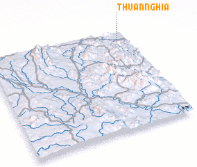 Places with similar names to Thuân Nghĩa, Vietnam ::
// Thunavy (LK)
// Thanh Phú (VN)
// Thanh Phú (VN)
// Thạnh Phú (VN)
// Thạnh Phú (VN)
// Thiện Nghĩa (VN)
// Thịnh Phú (VN)
// Thôn Phụ Ổ (VN)
// Thôn Vơi (VN)
// Thuan Vy (VN)
Disclaimer :: Information on this page comes without warranty of any kind |
||
|
Where is Thuân Nghĩa? Elevation and coordinates ::
Latitude (lat): 13°55'0"N Longitude (lon): 108°56'0"E
Elevation (approx.): 23m (map arrows pan, magnifying glasses zoom) |
||
|
Visiting Thuân Nghĩa? Hotel/Accommodation ::
Book a hotel in Thuân Nghĩa Travel Guide ::
Buy a travel guide for Vietnam rental cars ::
car rental offers GPS waypoint ::
download a GPX waypoint (PoI) of Thuân Nghĩa for your GPS receiver
|
||