|
search place name
|
||
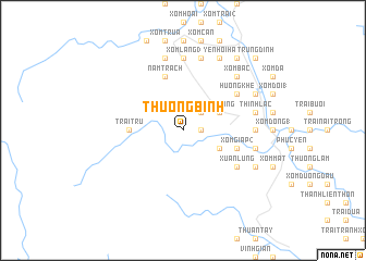
Thương Bình (Vietnam)Thương Bình is a town in Vietnam. An overview map of the region around Thương Bình is displayed below.
regional and 3d topo map of Thương Bình, Vietnam ::
Thương Bình airports ::
The nearest airport is SNO - Sakon Nakhon, located 194.4 km south west of Thương Bình.
Other airports nearby include ZVK - Savannakhet (202.6 km south west), Nearby towns ::
Phúc Âm Thôn (1.8km east) //
Loan Dã (1.8km east) //
Phú Gia (1.8km east) //
Làng Miên Thôn (2.6km north east) //
Hưng Thịnh (4.0km south east) //
Trung Thanh (4.0km south east) //
Yên Ðông (4.0km north east) //
Trại Trư (5.3km west) //
Bao Tại (5.6km east) //
Xóm Giáp (2) (5.6km east) //
Nam Trạch (5.8km north) //
Vĩnh Ðại (6.5km south east) //
Xuân Lung (6.5km south east) //
Hương Khê (6.5km north east) //
Xóm Làng (3) (7.4km north) //
Ðò Ngang (7.0km east) //
Thượng Hữu (7.4km north) //
Xóm Ðình (1) (7.3km east) //
Lộc Yên (7.3km east) //
Phúc Cư (7.6km north) //
Phúc Hội (7.6km north) //
Xóm Căng (7.6km north) //
Xóm Cây Dừa (7.6km north) //
Thịnh Lạc (7.3km east) //
Văn Ðồng (7.6km north) //
Xóm Bắc (7.7km north east) //
Ðông Bái (8.0km south east) //
Yên Hội Ha (8.2km north east) //
Hà Ðông (8.0km north east) //
[all distances 'as the bird flies' and approximate]  Places with similar names to Thương Bình, Vietnam ::
// Thăng Bình (VN)
// Thông Bên (VN)
Disclaimer :: Information on this page comes without warranty of any kind |
||
|
Where is Thương Bình? Elevation and coordinates ::
Latitude (lat): 18°11'0"N Longitude (lon): 105°38'0"E
Elevation (approx.): 64m (map arrows pan, magnifying glasses zoom) |
||
|
Visiting Thương Bình? Hotel/Accommodation ::
Book a hotel in Thương Bình Travel Guide ::
Buy a travel guide for Vietnam rental cars ::
car rental offers GPS waypoint ::
download a GPX waypoint (PoI) of Thương Bình for your GPS receiver
|
||