|
search place name
|
||
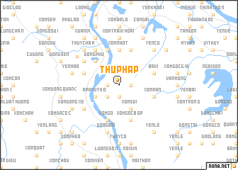
Thủ Pháp (Vietnam)Thủ Pháp is a town in Vietnam. An overview map of the region around Thủ Pháp is displayed below.
regional and 3d topo map of Thủ Pháp, Vietnam ::
Thủ Pháp airports ::
The nearest airport is HAN - Hanoi Noibai Intl, located 52.1 km east of Thủ Pháp.
Nearby towns ::
Ấp Tân My (1.7km west) //
Man Xuôi Hai (1.7km east) //
Mán Ba Ðằng (1.9km south) //
Xóm Lung (2.5km south west) //
Ấp Phú Thó (3.9km south west) //
Xóm Sui (4.1km south east) //
Ðồng Phú (5.1km north west) //
Xóm Nhót (5.6km north) //
Ba Vì (5.5km east) //
Xóm Gò (5.8km south) //
Chó Chẹ (5.8km south) //
Làng Tu Vũ (5.8km south) //
Ðoan Thượng (5.8km north) //
Ðồng Lũng (5.5km west) //
Xóm Gốc Bop (5.8km south) //
Xóm Trung Thượng (5.8km north) //
Xóm Mán (5.5km east) //
Ðồng Luận (6.5km north west) //
Ða Nghệ (6.4km north west) //
Trai Son (6.4km north west) //
Ấp Ðồng Xuân (6.4km south west) //
Ấp Ðá Chông (7.4km north) //
Xóm Trại Khoai (7.4km north) //
Ðồng Côc (7.2km west) //
Yên Mao (7.2km west) //
Ðồng Bài (7.6km south) //
Yên Cư (7.6km north east) //
Thủy Chạm (7.6km north west) //
Hoàng Xá (7.6km north west) //
[all distances 'as the bird flies' and approximate] 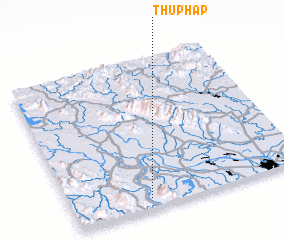 Places with similar names to Thủ Pháp, Vietnam :: Disclaimer :: Information on this page comes without warranty of any kind |
||
|
Where is Thủ Pháp? Elevation and coordinates ::
Latitude (lat): 21°4'0"N Longitude (lon): 105°20'0"E
Elevation (approx.): 147m (map arrows pan, magnifying glasses zoom) |
||
|
Visiting Thủ Pháp? Hotel/Accommodation ::
Book a hotel in Thủ Pháp Travel Guide ::
Buy a travel guide for Vietnam rental cars ::
car rental offers GPS waypoint ::
download a GPX waypoint (PoI) of Thủ Pháp for your GPS receiver
|
||