|
search place name
|
||
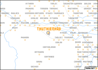
Thủ Thiện Hạ (1) (Vietnam)Thủ Thiện Hạ (1) is a town in Vietnam. An overview map of the region around Thủ Thiện Hạ (1) is displayed below.
regional and 3d topo map of Thủ Thiện Hạ (1), Vietnam ::
Thủ Thiện Hạ (1) airports ::
The nearest airport is NHA - Nhatrang, located 182.3 km south of Thủ Thiện Hạ (1).
Nearby towns ::
Nhỏn Nghĩa Tây (1.9km north) //
Cũ Lâm Bắc (2) (2.6km north east) //
Cũ Lâm Nam (1) (2.6km south east) //
Thủ Thiện Hạ (2) (2.6km north west) //
Ðông Lâm (4.0km north east) //
Phụ Ngọc (4.1km north east) //
Thọ Lộc (2) (4.0km south east) //
Thủ Thiện Hạ (4.0km north west) //
Quan Quang (1) (5.2km north east) //
Xóm Lá (1) (5.2km south east) //
Thọ Lộc (5) (5.2km south east) //
Lai Nghi (1) (5.2km north west) //
Mỹ Ngọc (5.4km east) //
Xóm Thọ Lâm Hạ (5.6km south) //
An Vinh (1) (5.6km north) //
Mỹ Thạnh (5.8km north) //
Ðại An (3) (5.8km north) //
Ðông Viên (2) (5.7km east) //
An Chánh (5.8km north) //
Thông Hòa (2) (6.5km north east) //
Lai Nghi (2) (6.5km north west) //
Mỹ Ðức (1) (7.4km north) //
Mỹ An (7.6km north) //
Trung Ái (1) (7.4km east) //
Vĩnh Lộc (7.7km north west) //
Thuận Ðức (1) (8.2km north east) //
Thạnh Danh (2) (8.1km north east) //
Thuận Hòa (1) (8.2km north west) //
Vân Tường (8.2km north west) //
[all distances 'as the bird flies' and approximate] 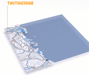 Places with similar names to Thủ Thiện Hạ (1), Vietnam :: Disclaimer :: Information on this page comes without warranty of any kind |
||
|
Where is Thủ Thiện Hạ (1)? Elevation and coordinates ::
Latitude (lat): 13°52'0"N Longitude (lon): 109°1'0"E
Elevation (approx.): 61m (map arrows pan, magnifying glasses zoom) |
||
|
Visiting Thủ Thiện Hạ (1)? Hotel/Accommodation ::
Book a hotel in Thủ Thiện Hạ (1) Travel Guide ::
Buy a travel guide for Vietnam rental cars ::
car rental offers GPS waypoint ::
download a GPX waypoint (PoI) of Thủ Thiện Hạ (1) for your GPS receiver
|
||