|
search place name
|
||
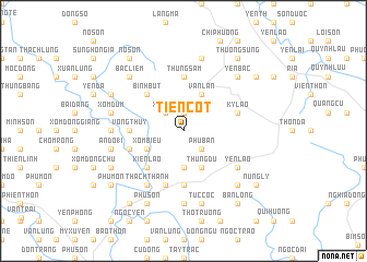
Tiên Cốt (Thanh Hóa, Vietnam)Tiên Cốt is a town in the Thanh Hóa region of Vietnam. An overview map of the region around Tiên Cốt is displayed below.
regional and 3d topo map of Tiên Cốt, Vietnam ::
Tiên Cốt airports ::
The nearest airport is HAN - Hanoi Noibai Intl, located 115.4 km north of Tiên Cốt.
Nearby towns ::
Ðồng Hội (1.9km north) //
Phù Bản (2.5km south east) //
Xóm Côn (2.5km north west) //
Thach Lỗi (3.7km south) //
Xóm Biều (3.9km south west) //
Thung Du (4.1km south east) //
Vãn Lan (4.1km north east) //
Kiên Lao (5.1km south west) //
Binh Bút (5.1km north west) //
Võng Thúy (5.2km west) //
Ðồng Khanh (5.6km south) //
Thung Sâm (5.6km north) //
An Do18 (5.5km west) //
Kỳ Lão (5.5km east) //
Mỹ Tân (5.8km south) //
Yên Lão (6.4km south east) //
Thạch Thành (6.6km south west) //
Trạc Nhật (7.4km south) //
Thọ Liêu (7.4km south) //
An Da (7.0km west) //
Tuc Cốc (7.6km south) //
An Ðo18 (7.2km west) //
Xóm Ðụm (7.2km west) //
Măc Thôn (7.6km north) //
Lộng Ngọc (7.6km south east) //
Bạc Liêm (7.6km north west) //
Yên Bạc (7.6km north east) //
Phú Sơn (8.2km south west) //
Phú Ổ (7.9km south west) //
[all distances 'as the bird flies' and approximate] 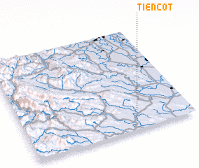 Places with similar names to Tiên Cốt, Vietnam ::
Disclaimer :: Information on this page comes without warranty of any kind |
||
|
Where is Tiên Cốt? Elevation and coordinates ::
Latitude (lat): 20°11'0"N Longitude (lon): 105°42'0"E
Elevation (approx.): 28m (map arrows pan, magnifying glasses zoom) |
||
|
Visiting Tiên Cốt? Hotel/Accommodation ::
Book a hotel in Tiên Cốt Travel Guide ::
Buy a travel guide for Vietnam rental cars ::
car rental offers GPS waypoint ::
download a GPX waypoint (PoI) of Tiên Cốt for your GPS receiver
|
||