|
search place name
|
||
Trại Vực Dựa (Thanh Hóa, Vietnam)Trại Vực Dựa is a town in the Thanh Hóa region of Vietnam. An overview map of the region around Trại Vực Dựa is displayed below.
regional and 3d topo map of Trại Vực Dựa, Vietnam ::

Trại Vực Dựa airports ::
The nearest airport is HAN - Hanoi Noibai Intl, located 192.4 km north of Trại Vực Dựa.
Nearby towns ::
Khe Tchang (4.1km south west) //
Làng Pha Rinh (5.1km north east) //
Làng Ky Phá (5.6km east) //
Làng Thê (7.6km north) //
Làng Cò Hat (9.1km north east) //
Bản Na Vai (8.9km north west) //
Bản Mùn (10.2km north west) //
Làng Suối (10.2km north east) //
[all distances 'as the bird flies' and approximate] 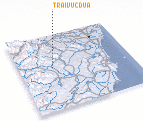 Places with similar names to Trại Vực Dựa, Vietnam ::
Disclaimer :: Information on this page comes without warranty of any kind |
||
|
Where is Trại Vực Dựa? Elevation and coordinates ::
Latitude (lat): 19°33'0"N Longitude (lon): 105°18'0"E
Elevation (approx.): 88m (map arrows pan, magnifying glasses zoom) |
||
|
Visiting Trại Vực Dựa? Hotel/Accommodation ::
Book a hotel in Trại Vực Dựa Travel Guide ::
Buy a travel guide for Vietnam rental cars ::
car rental offers GPS waypoint ::
download a GPX waypoint (PoI) of Trại Vực Dựa for your GPS receiver
|
||