|
search place name
|
||
Tràng Sơn (Vietnam)Tràng Sơn is a town in Vietnam. An overview map of the region around Tràng Sơn is displayed below.
regional and 3d topo map of Tràng Sơn, Vietnam ::

Tràng Sơn airports ::
The nearest airport is SNO - Sakon Nakhon, located 237.7 km south west of Tràng Sơn.
Nearby towns ::
Lương Hội (1.9km north) //
Hôi Yên (3.7km south) //
Yên Xá (3.7km north) //
Danh Nham (3.7km north) //
Viên Sơn (4.1km north west) //
Nam Thôn (4.0km north west) //
Ngọc Long Ha (4.0km north west) //
Xóm Yên Sơn (4.1km south east) //
Cỏ Văn (4.1km south east) //
Ngoc Thành (4.0km north east) //
Liên Trì (5.1km north west) //
Phúc Duệ (5.1km north west) //
Ðồng Quĩ (5.1km south east) //
Cô Lãm (5.6km south) //
Van Trai (5.6km north) //
Văn Sơn (5.6km north) //
Vân Nam (5.8km north) //
Làng Ðiển Yên (5.8km south) //
Ngọc Long Thượng (5.6km west) //
Vinh Tuy (5.8km north) //
Ða Chộ (6.6km south west) //
Phủ Yên (6.6km south west) //
Tam Ðông (6.6km north west) //
Vĩnh Ðòng (6.6km north west) //
Nôi Trung (6.4km north west) //
Nhạn Thap (6.6km north east) //
Ngoai Giáp (6.6km north east) //
Trụ Pháp (7.0km west) //
Phú Thọ (7.4km north) //
[all distances 'as the bird flies' and approximate] 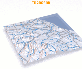 Places with similar names to Tràng Sơn, Vietnam ::
Disclaimer :: Information on this page comes without warranty of any kind |
||
|
Where is Tràng Sơn? Elevation and coordinates ::
Latitude (lat): 18°54'0"N Longitude (lon): 105°29'0"E
Elevation (approx.): 12m (map arrows pan, magnifying glasses zoom) |
||
|
Visiting Tràng Sơn? Hotel/Accommodation ::
Book a hotel in Tràng Sơn Travel Guide ::
Buy a travel guide for Vietnam rental cars ::
car rental offers GPS waypoint ::
download a GPX waypoint (PoI) of Tràng Sơn for your GPS receiver
|
||