|
search place name
|
||
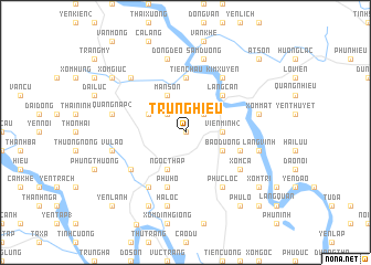
Trung Hiếu (Vĩnh Phú, Vietnam)Trung Hiếu is a town in the Vĩnh Phú region of Vietnam. An overview map of the region around Trung Hiếu is displayed below.
regional and 3d topo map of Trung Hiếu, Vietnam ::
Trung Hiếu airports ::
The nearest airport is HAN - Hanoi Noibai Intl, located 63.1 km south east of Trung Hiếu.
Nearby towns ::
Tra Vi (0.0km north) //
Làng Lang (2.5km north east) //
Tô Thôn (2.5km north west) //
Viên Minh (2) (3.4km east) //
Bảo Ðường (3.9km south east) //
Ngọc Tháp (4.1km south west) //
Mãn Sơn (4.1km north west) //
Thái Bình (3.9km north west) //
Làng Can (5.1km north east) //
Bai Cạo (5.6km north) //
Tiên Châu (5.6km north) //
Hạ Giáp (5.5km east) //
Phu Hó (5.8km south) //
Kim Xuyên (6.5km north east) //
Phức Lộc (6.5km south east) //
Xóm Cả (6.4km south east) //
Làng Bầng (6.4km south west) //
Binh Quân (6.5km south west) //
Bạch Lưu (7.1km east) //
Làng Vinh (7.1km east) //
Hà Lộc (7.6km south) //
Xóm Mát (7.1km east) //
Phần Lương (7.1km east) //
Sầm Ðương (7.6km north) //
Vũ Lao (7.1km west) //
Quang Nạp (2) (7.1km west) //
Ðồng Ðeo (7.6km north) //
Kim Lăng (7.6km north west) //
Chú Mật (8.2km south west) //
[all distances 'as the bird flies' and approximate]  Places with similar names to Trung Hiếu, Vietnam ::
Disclaimer :: Information on this page comes without warranty of any kind |
||
|
Where is Trung Hiếu? Elevation and coordinates ::
Latitude (lat): 21°29'0"N Longitude (lon): 105°16'0"E
Elevation (approx.): 48m (map arrows pan, magnifying glasses zoom) |
||
|
Visiting Trung Hiếu? Hotel/Accommodation ::
Book a hotel in Trung Hiếu Travel Guide ::
Buy a travel guide for Vietnam rental cars ::
car rental offers GPS waypoint ::
download a GPX waypoint (PoI) of Trung Hiếu for your GPS receiver
|
||