|
search place name
|
||
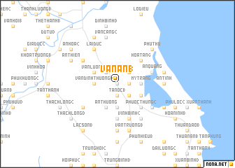
Vạn An (1) (Vietnam)Vạn An (1) is a town in Vietnam. An overview map of the region around Vạn An (1) is displayed below.
regional and 3d topo map of Vạn An (1), Vietnam ::
Vạn An (1) airports ::
The nearest airport is DAD - Danang Intl, located 212.6 km north west of Vạn An (1).
Nearby towns ::
Vạn Phú (1) (0.0km north) //
Vạn Thiết (1) (1.8km east) //
Tân Lộc (1) (1.9km south) //
Tân Ốc (1) (1.9km south) //
Quang Nghiễm (1) (2.6km north east) //
Lôc Thái (2) (2.6km north west) //
Dương Liễu (2) (2.6km south east) //
Châu Trúc (3.6km east) //
Mỹ Trang (3.6km east) //
An Bảo (2) (3.7km south) //
Vạn Ðịnh Thượng (1) (3.6km west) //
Chánh Khoan (1) (4.0km south east) //
Vạn Lương (1) (4.0km north west) //
An Thường (4.1km south west) //
Hoà Tân (6) (5.2km north east) //
An Giang (4) (5.2km north east) //
Phước Thung (2) (5.2km south east) //
Nghĩa Lộc (3) (5.6km south) //
Phước Chánh (1) (5.6km south) //
An Quảng (5.7km east) //
Vĩnh Bình (2) (5.8km south) //
Ân Ðôn (1) (6.5km north west) //
Vĩnh Ân (1) (6.6km south east) //
Phước Thung (1) (6.6km south east) //
Phú Ðức (6.6km south east) //
Cửu Thành (1) (6.5km south west) //
Mỹ Phú (1) (6.5km south east) //
Lại Ðức (6.6km north west) //
An Tịnh (7.2km east) //
[all distances 'as the bird flies' and approximate] 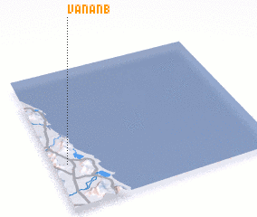 Places with similar names to Vạn An (1), Vietnam ::
Disclaimer :: Information on this page comes without warranty of any kind |
||
|
Where is Vạn An (1)? Elevation and coordinates ::
Latitude (lat): 14°19'0"N Longitude (lon): 109°4'0"E
Elevation (approx.): 13m (map arrows pan, magnifying glasses zoom) |
||
|
Visiting Vạn An (1)? Hotel/Accommodation ::
Book a hotel in Vạn An (1) Travel Guide ::
Buy a travel guide for Vietnam rental cars ::
car rental offers GPS waypoint ::
download a GPX waypoint (PoI) of Vạn An (1) for your GPS receiver
|
||