|
search place name
|
||
Van Tường (Vietnam)Van Tường is a town in Vietnam. An overview map of the region around Van Tường is displayed below.
regional and 3d topo map of Van Tường, Vietnam ::

Van Tường airports ::
The nearest airport is DAD - Danang Intl, located 122.6 km north west of Van Tường.
Nearby towns ::
Ðại Nham (0.0km north) //
Ân Phú (2) (1.8km west) //
Long Bang (1.8km west) //
Nha Hòa (1.9km north) //
Phú Tho (1) (1.8km east) //
Thanh Khiết (1) (1.8km east) //
Hổ Tiêu (1.8km east) //
Ba La (1) (2.6km south west) //
An Nhân (2.6km north west) //
An Ðạo (2.6km north east) //
Ðiên An (1) (3.7km south) //
Châu Thanh (3.7km north) //
Châu Sa (1) (3.7km north) //
Hưng Nhơn (2) (4.0km south east) //
Hương Trà (2) (4.1km north west) //
Mỹ Lại (4) (4.1km north east) //
Quận Ðăng (2) (5.2km south west) //
Bình Hòa (2) (5.2km south east) //
Thu Xá (5.2km south east) //
Phú Mỹ (3) (5.2km north west) //
Mỹ Khê (1) (5.2km north east) //
An Bình (1) (5.4km west) //
Vạn Thiện (5.6km north) //
An Thinh (3) (5.6km north) //
Ðiện An (2) (5.6km south) //
Phổ An (2) (5.4km east) //
Quảng Ngãi (5.7km west) //
Châu Sa (3) (5.8km north) //
Tư Nghĩa (5.8km south) //
[all distances 'as the bird flies' and approximate] 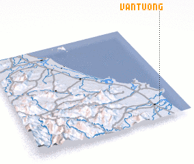 Places with similar names to Van Tường, Vietnam ::
Disclaimer :: Information on this page comes without warranty of any kind |
||
|
Where is Van Tường? Elevation and coordinates ::
Latitude (lat): 15°8'0"N Longitude (lon): 108°51'0"E
Elevation (approx.): 6m (map arrows pan, magnifying glasses zoom) |
||
|
Visiting Van Tường? Hotel/Accommodation ::
Book a hotel in Van Tường Travel Guide ::
Buy a travel guide for Vietnam rental cars ::
car rental offers GPS waypoint ::
download a GPX waypoint (PoI) of Van Tường for your GPS receiver
|
||