|
search place name
|
||
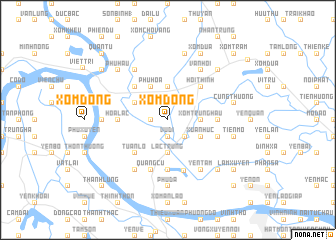
Xóm Ðông (Vietnam)Xóm Ðông is a town in Vietnam. An overview map of the region around Xóm Ðông is displayed below.
regional and 3d topo map of Xóm Ðông, Vietnam ::
Xóm Ðông airports ::
The nearest airport is HAN - Hanoi Noibai Intl, located 30.3 km east of Xóm Ðông.
Nearby towns ::
Yen Thuy (1.9km north) //
Vu Di (1.9km south) //
Sơn Tang (1.9km south) //
Bích Ðại (1.9km north) //
Thổ Tăng (1.7km west) //
Yên Lac (2.5km north east) //
Van O (2.5km south east) //
Gia Bang (3.5km east) //
Xóm Trung Hâu (3.5km east) //
Bồ Ðiền (3.7km south) //
Báo Văn (3.7km north) //
Lạc Trung (3.7km south) //
Xuân Húc (3.9km south east) //
Phủ Hoa (4.1km north west) //
Hòa Loan (3.9km north west) //
Hội Thịnh (5.1km north east) //
Bích Châu (5.1km south west) //
Hạc Ðinh (5.1km north west) //
Tuân Lộ (5.1km south west) //
Phuong Tri (5.2km east) //
Bình Trù (5.2km west) //
Hòa Lac (5.2km west) //
Phù Lập (5.6km south) //
Pho To (5.5km east) //
Quảng Cư (5.8km south) //
Tú Trưng (5.9km south) //
Yên Tâm (6.5km south east) //
Vân Hội (6.5km north east) //
Hoằng Xá (6.5km south west) //
[all distances 'as the bird flies' and approximate] 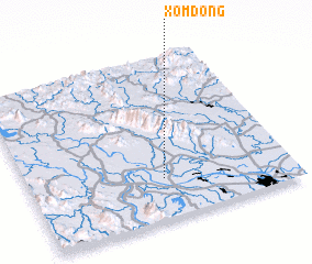 Places with similar names to Xóm Ðông, Vietnam ::
// Samadang (MM)
// Samdang (MM)
// Sam-tang (MM)
// Ciemiętniki (PL)
// Śmietanki (PL)
// Cimdenieki (LV)
// Samétienga (BF)
// Samtenga (BF)
// Sèmtenga (BF)
// Samudongo (CD)
Disclaimer :: Information on this page comes without warranty of any kind |
||
|
Where is Xóm Ðông? Elevation and coordinates ::
Latitude (lat): 21°15'0"N Longitude (lon): 105°31'0"E
Elevation (approx.): 17m (map arrows pan, magnifying glasses zoom) |
||
|
Visiting Xóm Ðông? Hotel/Accommodation ::
Book a hotel in Xóm Ðông Travel Guide ::
Buy a travel guide for Vietnam rental cars ::
car rental offers GPS waypoint ::
download a GPX waypoint (PoI) of Xóm Ðông for your GPS receiver
|
||